Related Keywords
contour downloadscontour map downloads
contour tracking downloads
contour plotting downloads
contour plot excel downloads
contour processor downloads
contour lines downloads
contour plot downloads
contour cutting downloads
3d 4d map contour isosurface downloads
x64 contour map downloads
color filled contour map downloads
x64 create contour map downloads
2d contour scanner downloads
color filled contour maps downloads
Top Software Keywords
autocad downloads3d cad downloads
cad downloads
drawing downloads
import downloads
pdf to dwg downloads
dwg downloads
design downloads
convert pdf to dwg downloads
dxf to pdf downloads
dwg to pdf downloads
pdf to dxf downloads
dwf to dwg downloads
converter downloads
dwg converter downloads
dwg to jpg downloads
dxf downloads
convert downloads
dwg to bmp downloads
stl downloads
dxf to pcl downloads
dwg to dxf downloads
dwg to tiff downloads
intellicad downloads
pdf to cad downloads
dwg to gif downloads
convert dwg to pdf downloads
dwg to png downloads
dxf to ps downloads
dwg to dwf downloads
Vista Download
Vista downloadVista antivirus download
Vista wallpaper download
Vista wallpapers download
Vista themes download
Vista pack download
Vista ultimate download
Vista home download
Vista basic download
Vista business download
Vista x64 download
Vista transformation download
Vista transformation pack download
Vista boot download
Vista dvd download
Vista sidebar download
Vista aero download
Vista product key download
Downloads RSS
Top Downloads
Top Rated
Navigation: Home
\ Graphic Apps
\ CAD \ Topography in AutoCAD
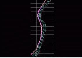
Topography in AutoCAD2.3 by Rcad Software |

|
Software Description:
... at projection. The POLYLINE may contain arcs. Color-filled contour maps can be also generated. In addition, you can draw a DWG file in Google Earth, by generating a 2D or 3D KML file type. The DWG file can be in any projected coordinate system and from any part of the globe. It is also possible to determine the flatness of the surfaces and you can import and export LandXML file type! ...
type: Shareware ($59.00)
Download Topography in AutoCADcategories: AutoCAD Add-ons, Topography, KML creator, KML 3D, XYZ File, LandXML, Triangulation, Isolines, Color-filled contour map, Sections, Volume, surface flatness, BricsCAD add Buy Now Add to Download Basket Report virus or spyware |
 [ Zoom screenshot ] |
|
| Software Info | |
|
Best Vista Download periodically updates pricing and software information of Topography in AutoCAD full version from the publisher,
but some information may be out-of-date. You should confirm all information. Software piracy is theft, using crack, warez passwords, patches, serial numbers, registration codes, key generator, keymaker or keygen for Topography in AutoCAD license key is illegal and prevent future development of Topography in AutoCAD. Download links are directly from our mirrors or publisher's website, Topography in AutoCAD torrent files or shared files from rapidshare, yousendit or megaupload are not allowed! |
|
| Website: | Rcad Software - Topography in AutoCAD homepage |
| Released: | December 29, 2022 |
| Filesize: | 2.46 MB |
| Language: | English |
| Platform: | Win2000, Windows XP, Windows 7 x32, Windows 7 x64, Windows 8, Windows 10, WinServer, WinOther, Windows 2000, Windows 2003, Windows Server 2000, Windows Server 2003, Windows Server 2008, Windows Server 2008r2, Windows Server 2012, Windows Tablet PC Edition 2005, Windows Media Center Edition 2005, Windows Vista, Windows Vista x64 |
| Requirements: | AUTOCAD version at least 2010 or BricsCAD at least V14 |
| Install | Install and Uninstall |
| Add Your Review or Windows Vista Compatibility Report |
Topography in AutoCAD- Releases History |
| Software: | Topography in AutoCAD 2.3 |
| Date Released: | Sep 26, 2020 |
| Status: | New Release |
| Release Notes: | It can be purchased with a 1-year subscription. |
| Software: | Topography in AutoCAD 2.3d |
| Date Released: | Sep 26, 2020 |
| Status: | New Release |
| Release Notes: | It can be purchased with a 1-year subscription. |
| Software: | Topography in AutoCAD 2.3 |
| Date Released: | Jan 2, 2019 |
| Status: | New Release |
| Release Notes: | It exports 3D objects from DWG to Google Earth. |
Most popular contour in CAD downloads for Vista |
|
Origin 10.5.70 download by OriginLab Corp.
... quality graphs to suit your needs. Many popular contour, 2D, and 3D graph types are supported, as are specialty graphs such as windrose, stock (OHLC), ternary (including ternary-contour), 2D vector ...
type: Trialware ($69.00)
View Details
Download
categories: Create Graph, Create Plot, Vector Analysis, Graph, Vector, Statistics |
 |
|
TARGET 3001 20.6.0.58 download by Ing.-Buero FRIEDRICH
... 3001! itself consists of schematic, mixed mode simulation, contour autorouter, autoplacer, PCB layout, 3D view with a STEP export, basic EMC check and a frontpanel layout. It provides manufacturing data ...
type: Trialware ($59.00)
View Details
Download
categories: Mode Simulation, Shape Based, PCB Layout, CAD, shape, Simulation |
 |
|
TNTmips 20240404 download by MicroImages, Inc.
... from 3D information. Fast and efficient Surface Fitting, Contouring, and Triangulation operations produce Digital Elevation Model rasters (DEMs), contour lines, and triangulated irregular networks (TINs), respectively ... ...
type: Freeware
View Details
Download
categories: GIS data analysis, analyze geodetic data, edit GIS dataset, GIS, dataset, editor, analysis |
 |
|
AutoLisp Source 1.1 download by Rcad Software
... z code, - "B-spline control polygon and interpolated contour lines" creates the control polygon and interpolates a ... control its curvature; you can also generate interpolated contour lines, - "Intersect 2 3DFACE and contour lines" ...
type: Shareware ($100.00)
View Details
Download
categories: AutoLisp, source code, CAD for Topography, XYZ File viewer, Triangulation, Isolines, contour lines, XYZ point file, 4D points cloud viewer, DWG to XYZ |
 |
|
TRIANGULATION for IntelliCAD 3.9d download by Rcad Software
... 3DINTERSECTION, cross sections and a longitudinal profile, color-filled contour map; 7 functions for IntelliCAD versions which can ... may contain arcs. You can also make color-filled contour map. The price is for the first license! ...
type: Shareware ($29.00)
View Details
Download
categories: TRIANGULATION, ISOLINES, VOLUME, INTERSECTION, XYZ points files, IntelliCAD, TOPOGRAPHY, Software, SHAREWARE, XYZ POINTS, CROSS SECTIONS, LONGITUDINAL PROFILES, Surveying, CAD, DXF |
 |
|
RTOPO Hydrology 3.4 download by Rcad Software
... for surveying. You can do triangulation, isolines, color-filled contour maps, sections, intersections, volume and much more. You ... on a convex hull or between an external contour and possibly more interior contours -contour lines and ...
type: Shareware ($125.00)
View Details
Download
categories: CAD for Topography, XYZ File editor, hydrology, LandXML, Triangulation, Isolines, Cross sections, Longitudinal profile, Intersection of two triangulations, quartic triangular patches |
 |
|
Topography in AutoCAD 2.3 download by Rcad Software
... at projection. The POLYLINE may contain arcs. Color-filled contour maps can be also generated. In addition, you can draw a DWG file in Google Earth, by generating a 2D or ...
type: Shareware ($59.00)
View Details
Download
categories: AutoCAD Add-ons, Topography, KML creator, KML 3D, XYZ File, LandXML, Triangulation, Isolines, Color-filled contour map, Sections, Volume, surface flatness, BricsCAD add |
 |
|
LanDTM 6.1 download by Aplicaciones Topográficas S.L.
... possibility to include break-lines and to draw the contour lines without smoothing or with a reliable smoothing ... and too, you can add labels on the contour lines. So, the program is the mother ...
type: Freeware
View Details
Download
categories: Delaunay triangulation, Terrain Representation, CAD addon, Delaunay triangulation, Calculate, Terrain |
 |
|
ContourTrace 2022 2.3.1.0 download by KUHN SOLUTIONS
ContourTrace enables an easy, fast and convenient extraction of contours from images. The extraction of the contours is made possible by applying different filters and algorithms to the input image. The extracted contours can be exported into the DXF and SVG ...
type: Shareware ($19.00)
View Details
Download
categories: Image Vectorizer, Image to DXF ans SVG converter, Image to DXF, Image, DXF, Picture, Contour, Converter, 2D Scan, 2D Contour Scanner, CAD, DXF format |
 |
|
RTOPO LT 3.3 download by Rcad Software
... loading and drawing XYZ files of points, triangulation, contour lines and color-filled contour maps. You can also draw 4D points cloud ...
type: Shareware ($29.00)
View Details
Download
categories: CAD for Topography, XYZ File viewer, Triangulation, Isolines, contour lines, color filled contour maps, 4D points cloud viewer |
 |