Related Keywords
data distribution downloadsdistribution downloads
distribution list downloads
distribution lists downloads
distribution management downloads
distribution lists export downloads
distribution system downloads
distribution centers downloads
distribution processor downloads
distribution software downloads
distribution network downloads
distribution system simulator downloads
distribution of pdf downloads
distribution of files downloads
distribution barcode maker downloads
distribution barcode creator downloads
distribution labelling program downloads
distribution barcode generator downloads
data downloads
data backup downloads
Top Software Keywords
autocad downloadscad downloads
3d cad downloads
drawing downloads
import downloads
design downloads
dwg downloads
pdf to dwg downloads
dxf downloads
convert downloads
convert pdf to dwg downloads
dwg to pdf downloads
converter downloads
dxf to pdf downloads
dwg to dxf downloads
pdf to dxf downloads
dwf to dwg downloads
dwg to jpg downloads
dwg converter downloads
dwg to bmp downloads
stl downloads
dxf to pcl downloads
dwg to tiff downloads
intellicad downloads
pdf to cad downloads
dwg to gif downloads
convert dwg to pdf downloads
dwg to png downloads
dwg to dwf downloads
dxf to ps downloads
Vista Download
Vista downloadVista antivirus download
Vista wallpaper download
Vista wallpapers download
Vista themes download
Vista pack download
Vista ultimate download
Vista home download
Vista basic download
Vista business download
Vista x64 download
Vista transformation download
Vista transformation pack download
Vista boot download
Vista dvd download
Vista sidebar download
Vista aero download
Vista product key download
Downloads RSS
Top Downloads
Top Rated
Navigation: Home
\ Graphic Apps
\ CAD \ Virtual Terrain Project for Windows
Virtual Terrain Project for Windows1.1 110804 by Ben Discoe |

|
Software Description:
The goal of VTP is to foster the creation of tools for easily constructing any part of the real world in interactive, 3D digital form.This goal will require a synergetic convergence of the fields of CAD, GIS, visual simulation, surveying and remote sensing. VTP gathers information and tracks progress in areas such as procedural scene construction, feature extraction, and rendering algorithms. ...
type: Open Source
Download Virtual Terrain Project for Windowscategories: libraries, demos, data, open source, VirtualTerrain Project, CAD, GIS, VTP Add to Download Basket Report virus or spyware |
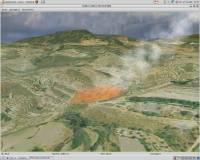 [ Zoom screenshot ] |
|
| Software Info | |
|
Best Vista Download periodically updates pricing and software information of Virtual Terrain Project for Windows full version from the publisher,
but some information may be out-of-date. You should confirm all information. Software piracy is theft, using crack, warez passwords, patches, serial numbers, registration codes, key generator, keymaker or keygen for Virtual Terrain Project for Windows license key is illegal and prevent future development of Virtual Terrain Project for Windows. Download links are directly from our mirrors or publisher's website, Virtual Terrain Project for Windows torrent files or shared files from rapidshare, yousendit or megaupload are not allowed! |
|
| Released: | September 08, 2011 |
| Filesize: | 1.00 MB |
| Platform: | Windows 2000, Windows 2003, Windows XP, Windows Vista |
| Install | Instal And Uninstall |
| Add Your Review or Windows Vista Compatibility Report |
Virtual Terrain Project for Windows- Releases History |
| Software: | Virtual Terrain Project for Windows 1.1 110804 |
| Date Released: | Sep 8, 2011 |
| Status: | New Release |
| Release Notes: | Enviro: Exposed support for more stereo modes: Horizontal and Vertical split. Options to enable joystick and spacenavigator, rather than just always using them if present. Smooth continuous update when making buildings. Option to constrain building point to right angles. Deter user from making bad points. Made support for Collada (.dae) more explicit in the UI. Display the version number in the startup dialog. Added 'every N meters' option to Contour dialog, making it significantly more useful. Changed 'Move' mode to use Alt modifier key for up/down, to be consistent. Fixed issues with: support for elevation grids with non-unit vertical scale; removing layers from a terrain; saving snapshot and high-resolution snapshot; buildings with a Geographic CRS; draping of 2D polylines on terrain with vertical exaggeration. VTBuilder: Raw layers: Draw polygon holes as dotted lines to tell them from outer edges. |
Most popular data distribution in CAD downloads for Vista |
|
CurveExpert Professional 2.7.3 download by Daniel G. Hyams
... is a cross-platform solution for curve fitting and data analysis. Data can be modelled using a toolbox of linear ... can be automated by letting CurveExpert compare your data to each model to choose the best curve. ...
View Details
Download
|
 |
|
PowerStar 5.22 download by Megasys Software
... Use it for commercial building services, industrial plants, distribution systems, power factor correction. Any project where you ... other properties. Mouseover any symbol to display electrical data. Highlight devices with overcurrent, kVA/kW overload, over/undervoltage. Print ...
type: Trialware ($160.00)
View Details
Download
categories: Electrical Design, Voltage Analysis, Analyze Voltage, Design, Voltage, Circuit |
 |
|
WindRose PRO 3.1.54.0 download by Enviroware s.r.l.
... software for plotting wind roses and other directional data. Data can be loaded as comma separated values (CSV) ... as KML files for Google Earth. Numerical data can be exported as text files or as ...
type: Trialware ($99.00)
View Details
Download
categories: plot wind rose, save plot, plot directional data, plot, wind rose, directional |
 |
|
IrriPro 3.1 download by Irriworks
... possible, thanks to the INDO technology (Irrigation Network Data Object) developed by Irriworks, to draw the elements ... optimizes the use of water and improves the distribution uniformity, increasing the system efficiency and ensuring the ...
View Details
Download
|
 |
|
Thuban for Windows 1.2.2 download by Thuban Development Team
Thuban is an interactive geographic data viewer (GIS viewer) which features methods to visualize, ... geographic information. Thuban is an Interactive Geographic Data Viewer with the following features: # Vector ...
type: Open Source
View Details
Download
categories: geographic data viewer, gis viewer, analyze geographic information, information, geographic, viewer |
 |
|
Virtual Terrain Project for Windows 1.1 110804 download by Ben Discoe
The goal of VTP is to foster the creation of tools for easily constructing any part of the real world in interactive, 3D digital form. This goal will require a ...
type: Open Source
View Details
Download
categories: libraries, demos, data, open source, VirtualTerrain Project, CAD, GIS, VTP |
 |
|
PowerNet 5.32 download by Megasys Software
... operations, as well as power generation, transmission and distribution systems. PowerNet can calculate meshed network configuration as well as radial type distribution. Use it to design and analyze electrical systems ...
type: Demo ($250.00)
View Details
Download
categories: circuit analyzer, circuit calculation, power circuit, circuit, analyzer, calculator |
 |
|
Pro Yacht 1.0.0.1 download by Marcus Bole
... aid physical modelling. Manipulation of hull section data is rarely supported in modern hull design tools. ... of powerful polyline processing functions which allow the distribution of points and section curves to be adjusted, ...
type: Freeware
View Details
Download
categories: calculate hydrostatic coefficient, ship displacement, design ship hull, ship, design, create |
 |
|
Multiwfn 3.7 download by sobereva
... wavefunction analysis is remarkably simplified, especially for studying distribution of real space function. High efficiency: · ... map. · Outputting properties in a spatial scope, data can be exported to Gaussian-type grid file (.cub) ...
type: Open Source
View Details
Download
categories: wavefunction analysis, topology analysis, molecular structure, analysis, analize, wavefunction |
 |
|
MountainsMap Scanning Topography 6.2.6266 download by Digital Surf
... be able to easily analyze measurements and metrology data. It features an extensive set of surface texture ... incremental optional modules for advanced applications. Analyzes measurement data in accordance with the latest standards and methods. ...
type: Trialware
View Details
Download
categories: surface profilometer, scanning opography, surface analysis, topography, profilometer, surface |
 |