Related Keywords
data file downloadsdata file recovery software downloads
data file recovery downloads
data file recovery services downloads
data file shredder downloads
data file recovery for compact flash downloads
clarion data file downloads
outlook data file password downloads
convert outlook data file downloads
recover sql data file downloads
convert lotus notes data file downloads
outlook data file to notes downloads
recover data file downloads
restore access data file downloads
outlook data file to mht downloads
divide outlook data file downloads
split outlook data file downloads
upgrade outlook data file downloads
repair access data file downloads
convert outlook data file pst downloads
Top Software Keywords
autocad downloadscad downloads
3d cad downloads
drawing downloads
import downloads
design downloads
dwg downloads
dxf downloads
pdf to dwg downloads
convert downloads
convert pdf to dwg downloads
dwg to pdf downloads
converter downloads
dxf to pdf downloads
dwg to dxf downloads
pdf to dxf downloads
dwf to dwg downloads
dwg converter downloads
dwg to jpg downloads
dwg to bmp downloads
stl downloads
dxf to pcl downloads
dwg to tiff downloads
intellicad downloads
pdf to cad downloads
dwg to gif downloads
convert dwg to pdf downloads
dwg to png downloads
dwg to dwf downloads
dxf to ps downloads
Vista Download
Vista downloadVista antivirus download
Vista wallpaper download
Vista wallpapers download
Vista themes download
Vista pack download
Vista ultimate download
Vista home download
Vista basic download
Vista business download
Vista x64 download
Vista transformation download
Vista transformation pack download
Vista boot download
Vista dvd download
Vista sidebar download
Vista aero download
Vista product key download
Downloads RSS
Top Downloads
Top Rated
Navigation: Home
\ Graphic Apps
\ CAD \ wxGIS Portable
wxGIS Portable0.4.1 by Dmitry Barishnikov |

|
Software Description:
... systems in folders. It also includes a vector file export utility and a tool for correcting the orthographic data from raster TIFF files. ...
type: Open Source
Download wxGIS Portablecategories: GIS catalog, manage geography data, geographic coordinate system, manage, catalog, geography Add to Download Basket Report virus or spyware |
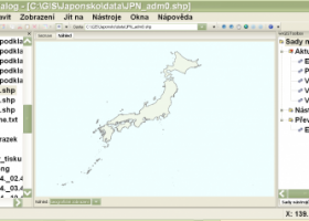 [ Zoom screenshot ] |
|
| Software Info | |
|
Best Vista Download periodically updates pricing and software information of wxGIS Portable full version from the publisher,
but some information may be out-of-date. You should confirm all information. Software piracy is theft, using crack, warez passwords, patches, serial numbers, registration codes, key generator, keymaker or keygen for wxGIS Portable license key is illegal and prevent future development of wxGIS Portable. Download links are directly from our mirrors or publisher's website, wxGIS Portable torrent files or shared files from rapidshare, yousendit or megaupload are not allowed! |
|
| Released: | November 15, 2012 |
| Filesize: | 9.70 MB |
| Platform: | Windows XP, Windows Vista, Windows Vista x64, Windows 7, Windows 7 x64 |
| Install | Instal And Uninstall |
| Add Your Review or Windows Vista Compatibility Report |
wxGIS Portable- Releases History |
| Software: | wxGIS Portable 0.4.1 |
| Date Released: | Nov 15, 2012 |
| Status: | New Release |
| Release Notes: | · The DEM interpolation switch (bilinear or cubic) in orthocorrect tool · Russian interface translation · Rename item support · Automatic rename output files in batch export · The ortho-correction tool become more accurate and speedy |
Most popular data file in CAD downloads for Vista |
|
Pro Yacht 1.0.0.1 download by Marcus Bole
... aid physical modelling. Manipulation of hull section data is rarely supported in modern hull design tools. ... to be adjusted, reducing complexity so that the data can be used for hydrodyamic analysis. For the ...
type: Freeware
View Details
Download
categories: calculate hydrostatic coefficient, ship displacement, design ship hull, ship, design, create |
 |
|
Gephi 0.10.1 download by Mathieu Bastian
... explore and understand graphs. Like Photoshop but for data, the user interacts with the representation, manipulate the ... reveal hidden properties. The goal is to help data analysts to make hypothesis, intuitively discover patterns, isolate ...
type: Open Source
View Details
Download
categories: interactive visualization, exploration platform, visualization platform, visualization, exploration, graph |
 |
|
MITO 2.0 download by Giuseppe De Pietro
... MITO provides interaction techniques for manipulating 3D medical data in a virtual environment by 2 DOF input devices. FEATURES: · DICOM compliant · 2D / 3D / S3D ...
type: Open Source
View Details
Download
categories: view DICOM file, DICOM file viewer, image segmentation, display, view, viewer |
 |
|
DXF Export Java 7 download by CADSoftTools
... with their properties, to stream or AutoCAD DXF files at high speed and with ease. Creating a new DXF file takes only one call of the exporter class, provided that user data has been prepared and loaded to the required ...
type: Shareware ($900.00)
View Details
Download
categories: DXF, Java, dxf in java, export dxf java, dxf export java, java dxf export, java dxf exporter, Export, Exporter, CAD, library, sdk, AutoCAD, output |
 |
|
Volocity 6.5.1 download by PerkinElmer
... resolution volume rendering of multichannel 3D and 4D data sets. Visualization puts you in full control of the way that you view 3D data, offering a choice of rendering methods so that ...
View Details
Download
|
 |
|
Volocity 64bit 6.5.1 download by PerkinElmer
... resolution volume rendering of multichannel 3D and 4D data sets. Visualization puts you in full control of the way that you view 3D data, offering a choice of rendering methods so that ...
type: Demo
View Details
Download
categories: imaging software x64, 3D imaging x64, 3D analysis x64, imaging x64, analysis x64, microscopy x64 |
 |
|
GedScape 3.0.01 download by Tenset Technologies Ltd.
... software utility for browsing, manipulating, converting and extracting data from GEDCOM files. It is the ideal GEDCOM viewer and converter, ... tool for genealogists. Features: Easily browse all data for individuals and families within GEDCOM files, including ...
type: Trialware ($39.00)
View Details
Download
categories: GEDCOM viewer, GEDCOM extractor, GEDCOM browser, GEDCOM, genealogy, family tree |
 |
|
SDMetrics 2.5 download by Jürgen Wüst
... SDMetrics with reverse engineering tools that produce XMI files from C++, Java, Delphi, or Smalltalk source code, ... to perform design measurement on such sources. Data export: · Design measures unleash their full potential ...
type: Freeware
View Details
Download
categories: analyze structural property, design metrics, establish benchmark, analyzer, analyze, measurement |
 |
|
Engauge Digitizer for Windows 12.0 download by Mark Mitchell
... This open source, digitizing software converts an image file showing a graph or map, into numbers. The image file can come from a scanner, digital camera or ... spreadsheet. The process starts with an image file containing a graph or map. The final result ...
type: Open Source
View Details
Download
categories: digitize image, image to number, process image, digitize, convert, digitizer |
 |
|
GOM Inspect 7.5 SR1 download by GOM
... and viewer for ATOS and GOM Inspect Professional data sets. Features from GOM Inspect include CAD Data and 3D Point Cloud Import 3D Mesh Processing 3D Inspection Tools 2D Analysis Comprehensive Reporting Data Export Extensive, certified inspection tools GOM ...
View Details
Download
|
 |