Related Keywords
data source downloadsdata source paging downloads
data source icons downloads
data source name downloads
sharepoint data source downloads
connect data source downloads
source code downloads
source downloads
source control downloads
source code documentation downloads
source codes downloads
source code metrics downloads
source editor downloads
source code obfuscator downloads
source code editor downloads
source code print downloads
source code library downloads
source code manager downloads
source code font downloads
source code organizer downloads
Top Software Keywords
autocad downloadscad downloads
3d cad downloads
drawing downloads
import downloads
design downloads
dwg downloads
dxf downloads
pdf to dwg downloads
convert downloads
convert pdf to dwg downloads
dwg to pdf downloads
converter downloads
dxf to pdf downloads
dwg to dxf downloads
pdf to dxf downloads
dwf to dwg downloads
dwg to jpg downloads
dwg converter downloads
dwg to bmp downloads
stl downloads
dxf to pcl downloads
dwg to tiff downloads
intellicad downloads
pdf to cad downloads
dwg to gif downloads
convert dwg to pdf downloads
dwg to png downloads
dwg to dwf downloads
dxf to ps downloads
Vista Download
Vista downloadVista antivirus download
Vista wallpaper download
Vista wallpapers download
Vista themes download
Vista pack download
Vista ultimate download
Vista home download
Vista basic download
Vista business download
Vista x64 download
Vista transformation download
Vista transformation pack download
Vista boot download
Vista dvd download
Vista sidebar download
Vista aero download
Vista product key download
Downloads RSS
Top Downloads
Top Rated
Navigation: Home
\ Graphic Apps
\ CAD \ Virtual Terrain Project for Windows
Virtual Terrain Project for Windows1.1 110804 by Ben Discoe |

|
Software Description:
The goal of VTP is to foster the creation of tools for easily constructing any part of the real world in interactive, 3D digital form.This goal will require a synergetic convergence of the fields of CAD, GIS, visual simulation, surveying and remote sensing. VTP gathers information and tracks progress in areas such as procedural scene construction, feature extraction, and rendering algorithms. ...
type: Open Source
Download Virtual Terrain Project for Windowscategories: libraries, demos, data, open source, VirtualTerrain Project, CAD, GIS, VTP Add to Download Basket Report virus or spyware |
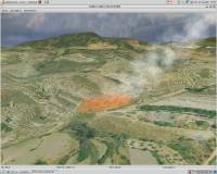 [ Zoom screenshot ] |
|
| Software Info | |
|
Best Vista Download periodically updates pricing and software information of Virtual Terrain Project for Windows full version from the publisher,
but some information may be out-of-date. You should confirm all information. Software piracy is theft, using crack, warez passwords, patches, serial numbers, registration codes, key generator, keymaker or keygen for Virtual Terrain Project for Windows license key is illegal and prevent future development of Virtual Terrain Project for Windows. Download links are directly from our mirrors or publisher's website, Virtual Terrain Project for Windows torrent files or shared files from rapidshare, yousendit or megaupload are not allowed! |
|
| Released: | September 08, 2011 |
| Filesize: | 1.00 MB |
| Platform: | Windows 2000, Windows 2003, Windows XP, Windows Vista |
| Install | Instal And Uninstall |
| Add Your Review or Windows Vista Compatibility Report |
Virtual Terrain Project for Windows- Releases History |
| Software: | Virtual Terrain Project for Windows 1.1 110804 |
| Date Released: | Sep 8, 2011 |
| Status: | New Release |
| Release Notes: | Enviro: Exposed support for more stereo modes: Horizontal and Vertical split. Options to enable joystick and spacenavigator, rather than just always using them if present. Smooth continuous update when making buildings. Option to constrain building point to right angles. Deter user from making bad points. Made support for Collada (.dae) more explicit in the UI. Display the version number in the startup dialog. Added 'every N meters' option to Contour dialog, making it significantly more useful. Changed 'Move' mode to use Alt modifier key for up/down, to be consistent. Fixed issues with: support for elevation grids with non-unit vertical scale; removing layers from a terrain; saving snapshot and high-resolution snapshot; buildings with a Geographic CRS; draping of 2D polylines on terrain with vertical exaggeration. VTBuilder: Raw layers: Draw polygon holes as dotted lines to tell them from outer edges. |
Most popular data source in CAD downloads for Vista |
|
Maxima 5.44.0 download by Sourceforge
... floating point numbers. Maxima can plot functions and data in two and three dimensions. Maxima itself is reasonably feature complete at this stage, with abilities such as symbolic integration, 3D ...
type: Open Source
View Details
Download
categories: numerical expression, symbolic symbolic, Laplace transforms, expression, numerical, symbolic |
 |
|
Gephi 0.10.1 download by Mathieu Bastian
... explore and understand graphs. Like Photoshop but for data, the user interacts with the representation, manipulate the ... reveal hidden properties. The goal is to help data analysts to make hypothesis, intuitively discover patterns, isolate ...
type: Open Source
View Details
Download
categories: interactive visualization, exploration platform, visualization platform, visualization, exploration, graph |
 |
|
MITO 2.0 download by Giuseppe De Pietro
... MITO provides interaction techniques for manipulating 3D medical data in a virtual environment by 2 DOF input devices. FEATURES: · DICOM compliant · 2D / 3D / S3D ...
type: Open Source
View Details
Download
categories: view DICOM file, DICOM file viewer, image segmentation, display, view, viewer |
 |
|
Engauge Digitizer for Windows 12.0 download by Mark Mitchell
Engauge Digitizer - Digitizing software This open source, digitizing software converts an image file showing a ... graph or map. The final result is digitized data that can be used by other tools such ...
type: Open Source
View Details
Download
categories: digitize image, image to number, process image, digitize, convert, digitizer |
 |
|
OsziViewer 1.30.0.0 download by Ralf Tralow
... simple, easy to use application designed to acquire data from the oscilloscope LeCroy9400A over the serial bus and from the PM3311 over an own bus. ...
type: Open Source
View Details
Download
categories: grab oscilloscope data, get oscilloscope data, LeCroy9400A oscilloscope, acquire, grab, grabber |
 |
|
PyMOL 3.0.3 download by DeLano Scientific LLC
... colleagues exactly as intended. Using PyMOL, data can be represented in nearly 20 different ways. ... ANIMATE Molecules Dynamically EXPORT PyMOL Geometry PRESENT 3D Data with AxPyMOL DEVELOP with JyMOL ...
type: Shareware ($99.00)
View Details
Download
categories: molecular visualization, molecular model, 3D molecular structure, molecular, visualization, structure |
 |
|
Thuban for Windows 1.2.2 download by Thuban Development Team
Thuban is an interactive geographic data viewer (GIS viewer) which features methods to visualize, ... geographic information. Thuban is an Interactive Geographic Data Viewer with the following features: # Vector ...
type: Open Source
View Details
Download
categories: geographic data viewer, gis viewer, analyze geographic information, information, geographic, viewer |
 |
|
Ocapy 0.402 download by Didier Gosseau
... Runs under Windows 2000, XP, Vista, Seven. Open source software. · Implement RPN (Reverse Polish Notation) like ... to switch between mouse option selections and keyboard data entry fields. · Virtual keyboards adapted to all ...
type: Open Source
View Details
Download
categories: science calculator, engineer calculator, math calculator, calculator, calculation, calculate |
|
AMDORAP 1.0.6 download by Hiroki Takahashi
... in high-resolution MS analyses mainly because of the data size. Our aim is to estimate more accurate ... values and extract interesting m/z values from raw data in comparative LC-orbitrap analysis. This project has been ...
View Details
Download
|
 |
|
Woodland Potential Calculator 2.01 download by Michell Computing
Woodland Potential Calculator was specially developed as a data collection and presentation instrument. It is designed ... across the north west of England. The data was sub-divided into sub-regions by landscape type using ...
type: Open Source
View Details
Download
categories: calculate potential, tree cover, potential calculation, calculator, potential, tree |
 |