Related Keywords
file data downloadsfile data recovery downloads
file data extractor downloads
cd file data recovery software downloads
restore excel file data downloads
get file data downloads
word file data restoration downloads
save recovered docx file data downloads
view word file data downloads
repair docx file data downloads
docx file data recovery downloads
recover excel file data downloads
recover ost file data downloads
extract ost file data downloads
exporting pst file data downloads
convert pst file data downloads
recover outlook ost file data downloads
recovering excel file data downloads
recover pst file data downloads
access ost file data downloads
Top Software Keywords
autocad downloadscad downloads
3d cad downloads
drawing downloads
import downloads
design downloads
dwg downloads
dxf downloads
pdf to dwg downloads
convert downloads
convert pdf to dwg downloads
dwg to pdf downloads
converter downloads
dxf to pdf downloads
dwg to dxf downloads
pdf to dxf downloads
dwf to dwg downloads
dwg converter downloads
dwg to jpg downloads
dwg to bmp downloads
stl downloads
dxf to pcl downloads
dwg to tiff downloads
intellicad downloads
pdf to cad downloads
dwg to gif downloads
convert dwg to pdf downloads
dwg to png downloads
dwg to dwf downloads
dxf to ps downloads
Vista Download
Vista downloadVista antivirus download
Vista wallpaper download
Vista wallpapers download
Vista themes download
Vista pack download
Vista ultimate download
Vista home download
Vista basic download
Vista business download
Vista x64 download
Vista transformation download
Vista transformation pack download
Vista boot download
Vista dvd download
Vista sidebar download
Vista aero download
Vista product key download
Downloads RSS
Top Downloads
Top Rated
Navigation: Home
\ Graphic Apps
\ CAD \ QGIS
QGIS3.36.1 by Gary Sherman |

|
Software Description:
QGIS supports vector, raster, and database formats and lets you browse and create map data on your computer.QGIS supports many common spatial data formats (e.g. ESRI ShapeFile, geotiff). QGIS supports plugins ... The initial goal was to provide a GIS data viewer. ...
type: Open Source
Download QGIScategories: geographic information system, map creator, map viewer, GIS, geographic information, create, QGIS Add to Download Basket Report virus or spyware |
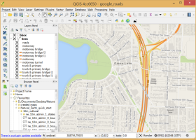 [ Zoom screenshot ] |
|
| Software Info | |
|
Best Vista Download periodically updates pricing and software information of QGIS full version from the publisher,
but some information may be out-of-date. You should confirm all information. Software piracy is theft, using crack, warez passwords, patches, serial numbers, registration codes, key generator, keymaker or keygen for QGIS license key is illegal and prevent future development of QGIS. Download links are directly from our mirrors or publisher's website, QGIS torrent files or shared files from rapidshare, yousendit or megaupload are not allowed! |
|
| Released: | March 26, 2024 |
| Filesize: | 1000.00 MB |
| Platform: | Windows XP, Windows Vista, Windows Vista x64, Windows 7, Windows 7 x64, Windows 8, Windows 8 x64, Windows 10, Windows 10 x64, Windows 11 |
| Install | Instal And Uninstall |
| Add Your Review or Windows Vista Compatibility Report |
QGIS- Releases History |
| Software: | QGIS 3.36.1 |
| Date Released: | Mar 26, 2024 |
| Status: | New Release |
| Software: | QGIS 3.36.2 |
| Date Released: | Apr 25, 2024 |
| Status: | New Release |
| Software: | QGIS 3.36.1 |
| Date Released: | Mar 26, 2024 |
| Status: | New Release |
Most popular file data in CAD downloads for Vista |
|
Pro Yacht 1.0.0.1 download by Marcus Bole
... aid physical modelling. Manipulation of hull section data is rarely supported in modern hull design tools. ... to be adjusted, reducing complexity so that the data can be used for hydrodyamic analysis. For the ...
type: Freeware
View Details
Download
categories: calculate hydrostatic coefficient, ship displacement, design ship hull, ship, design, create |
 |
|
PreviSat 6.1.0.3 download by Astropedia
... details. The results can be exported to TXT file format. PreviSat enables you to manage TLE orbital ... of orbital elements from the Internet and uploading data from TXT, TLE, or GZ file format. ...
type: Open Source
View Details
Download
categories: track satellite, satellite tracker, satellite position, track, tracker, position |
 |
|
DXF Export Java 7 download by CADSoftTools
... with their properties, to stream or AutoCAD DXF files at high speed and with ease. Creating a new DXF file takes only one call of the exporter class, provided that user data has been prepared and loaded to the required ...
type: Shareware ($900.00)
View Details
Download
categories: DXF, Java, dxf in java, export dxf java, dxf export java, java dxf export, java dxf exporter, Export, Exporter, CAD, library, sdk, AutoCAD, output |
 |
|
Volocity 6.5.1 download by PerkinElmer
... resolution volume rendering of multichannel 3D and 4D data sets. Visualization puts you in full control of the way that you view 3D data, offering a choice of rendering methods so that ...
View Details
Download
|
 |
|
Volocity 64bit 6.5.1 download by PerkinElmer
... resolution volume rendering of multichannel 3D and 4D data sets. Visualization puts you in full control of the way that you view 3D data, offering a choice of rendering methods so that ...
type: Demo
View Details
Download
categories: imaging software x64, 3D imaging x64, 3D analysis x64, imaging x64, analysis x64, microscopy x64 |
 |
|
Gephi 0.10.1 download by Mathieu Bastian
... explore and understand graphs. Like Photoshop but for data, the user interacts with the representation, manipulate the ... reveal hidden properties. The goal is to help data analysts to make hypothesis, intuitively discover patterns, isolate ...
type: Open Source
View Details
Download
categories: interactive visualization, exploration platform, visualization platform, visualization, exploration, graph |
 |
|
MITO 2.0 download by Giuseppe De Pietro
... MITO provides interaction techniques for manipulating 3D medical data in a virtual environment by 2 DOF input devices. FEATURES: · DICOM compliant · 2D / 3D / S3D ...
type: Open Source
View Details
Download
categories: view DICOM file, DICOM file viewer, image segmentation, display, view, viewer |
 |
|
enCIFer 1.4 download by Cambridge Crystallographic Data Centre
The Crystallographic Information File (CIF) is the internationally agreed standard file format for information exchange in crystallography. The CIF ... Crystallography (IUCr) and most major journals require electronic data depositions in CIF format. enCIFer enables users ...
View Details
Download
|
 |
|
Easy CAD to PDF Converter 3.2 download by Benzsoft
... even batch publish your DWG, DXF, DWF drawing files to PDF files of any size to answer your specific needs, ... PDF documents. · Batch conversion from multiple drawing files to multiple PDF files or one merged PDF ...
type: Shareware ($99.00)
View Details
Download
categories: CAD, PDF, DWG, DXF, DWF, CAD TO PDF, CAD2PDF, DWG TO PDF, DWG2PDF, DXF TO PDF, DXF2PDF, DWF TO PDF, DWF2PDF, convert, converter, conversion |
 |
|
GedScape 3.0.01 download by Tenset Technologies Ltd.
... software utility for browsing, manipulating, converting and extracting data from GEDCOM files. It is the ideal GEDCOM viewer and converter, ... tool for genealogists. Features: Easily browse all data for individuals and families within GEDCOM files, including ...
type: Trialware ($39.00)
View Details
Download
categories: GEDCOM viewer, GEDCOM extractor, GEDCOM browser, GEDCOM, genealogy, family tree |
 |