Related Keywords
for downloadsfor c c downloads
for each backup for security backup downloads
for kids downloads
for ipod downloads
for free downloads
for windows downloads
for children downloads
for 2 year olds downloads
for autocad downloads
for webnative downloads
for mac downloads
for woman downloads
for sale by owner downloads
for sale downloads
for mobile downloads
for windows xp downloads
for vista downloads
for psp downloads
for ms excel downloads
Top Software Keywords
autocad downloadscad downloads
3d cad downloads
drawing downloads
import downloads
design downloads
dwg downloads
dxf downloads
pdf to dwg downloads
convert downloads
convert pdf to dwg downloads
dwg to pdf downloads
converter downloads
dxf to pdf downloads
dwg to dxf downloads
pdf to dxf downloads
dwf to dwg downloads
dwg to jpg downloads
dwg converter downloads
dwg to bmp downloads
stl downloads
dxf to pcl downloads
dwg to tiff downloads
intellicad downloads
pdf to cad downloads
dwg to gif downloads
convert dwg to pdf downloads
dwg to png downloads
dwg to dwf downloads
dxf to ps downloads
Vista Download
Vista downloadVista antivirus download
Vista wallpaper download
Vista wallpapers download
Vista themes download
Vista pack download
Vista ultimate download
Vista home download
Vista basic download
Vista business download
Vista x64 download
Vista transformation download
Vista transformation pack download
Vista boot download
Vista dvd download
Vista sidebar download
Vista aero download
Vista product key download
Downloads RSS
Top Downloads
Top Rated
Navigation: Home
\ Graphic Apps
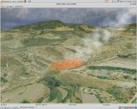
\ CAD \ Virtual Terrain Project for Windows
Virtual Terrain Project for Windows1.1 110804 by Ben Discoe |

|
Software Description:
... VTP is to foster the creation of tools for easily constructing any part of the real world in interactive, 3D digital form.This goal will require a synergetic convergence of the fields of CAD, GIS, visual simulation, surveying and remote sensing. VTP gathers information and tracks progress in areas such as procedural scene construction, feature extraction, and rendering algorithms. ...
type: Open Source
Download Virtual Terrain Project for Windowscategories: libraries, demos, data, open source, VirtualTerrain Project, CAD, GIS, VTP Add to Download Basket Report virus or spyware |
 [ Zoom screenshot ] |
|
| Software Info | |
|
Best Vista Download periodically updates pricing and software information of Virtual Terrain Project for Windows full version from the publisher,
but some information may be out-of-date. You should confirm all information. Software piracy is theft, using crack, warez passwords, patches, serial numbers, registration codes, key generator, keymaker or keygen for Virtual Terrain Project for Windows license key is illegal and prevent future development of Virtual Terrain Project for Windows. Download links are directly from our mirrors or publisher's website, Virtual Terrain Project for Windows torrent files or shared files from rapidshare, yousendit or megaupload are not allowed! |
|
| Released: | September 08, 2011 |
| Filesize: | 1.00 MB |
| Platform: | Windows 2000, Windows 2003, Windows XP, Windows Vista |
| Install | Instal And Uninstall |
| Add Your Review or Windows Vista Compatibility Report |
Virtual Terrain Project for Windows- Releases History |
| Software: | Virtual Terrain Project for Windows 1.1 110804 |
| Date Released: | Sep 8, 2011 |
| Status: | New Release |
| Release Notes: | Enviro: Exposed support for more stereo modes: Horizontal and Vertical split. Options to enable joystick and spacenavigator, rather than just always using them if present. Smooth continuous update when making buildings. Option to constrain building point to right angles. Deter user from making bad points. Made support for Collada (.dae) more explicit in the UI. Display the version number in the startup dialog. Added 'every N meters' option to Contour dialog, making it significantly more useful. Changed 'Move' mode to use Alt modifier key for up/down, to be consistent. Fixed issues with: support for elevation grids with non-unit vertical scale; removing layers from a terrain; saving snapshot and high-resolution snapshot; buildings with a Geographic CRS; draping of 2D polylines on terrain with vertical exaggeration. VTBuilder: Raw layers: Draw polygon holes as dotted lines to tell them from outer edges. |
Most popular for c c in CAD downloads for Vista |
|
Ascalaph Designer 1.8.94 download by Agile Molecule
The Ascalaph Designer application was developed for molecular models and simulations. Using this application you can simulate, molecular graphics, optimization, molecular dynamics, quantum chemistry. Features: Molecular graphics ...
type: Freeware
View Details
Download
categories: Molecular Model, Molecular Simulation, Molecular Designer, Molecular, Designer, Simulation |
 |
|
Rand Tree 2.0 download by Sourceforge
RandTree is a MatLab based tree simulator program where the algorithm is based on Honda's model. We have used probabilistic generation of branches in order to simulate visually realistic tree structures. ...
type: Open Source
View Details
Download
categories: tree generator, tree simulator, MATLAB tree, tree, simulator, generator |
 |
|
2D Batch Print for AutoCAD DWG, DXF, PLT 1 download by CADSoftTools
Automated Batch Print for drawings. No AutoCAD required. Batch Print is an ... HPGL, TIFF, SVG, CGM and other formats. Auto-detection for drawing sizes allows you to send different formats ... vector and raster graphics. It provides wide capabilities for filtering drawings and printing settings customization for further ...
type: Shareware ($300.00)
View Details
Download
categories: Batch Print, Batch, Print, Plot, DWG, DXF, CGM, SVG, HGL, PLT, SPL, HGL, HP2, edit, editor, view, viewer, Batch, converter, TIFF, DXF to TIFF, HPGL, Print, Printing, AutoCAD, EMF, BMP, format, Vector, HGL |
|
Automesher 2.4.8 download by Automapki
Automesher application extends AutoCAD and BricsCAD software with functionality to import and export 3D file formats and convert 3D drawing entity types. It supports many of 3D file extensions, including STL ...
type: Trialware ($29.50)
View Details
Download
categories: AutoCad, graphic, format, convert, Mesh exporter, Convert mesh, AutoCAD add-in, Export, Mesh, AutoCAD, Import |
 |
|
Cheewoo Pipe Simulator 2.2.1003.1007 download by Cheewoo Engineering
... window. Supporting NC block progress sequence speed adjustment for easy checking. Supporting zoom-in, zoom-out, panning, rotation, front ... top view, side view, and bird's eye view for user to check 3D NC cutting path easily ...
View Details
Download
|
 |
|
MITCalc3D for SolidWorks 1.70 download by MITCalc
... multi-language set of mechanical, industrial and technical calculations for the day-to-day routines. It will reliably, precisely, and ... of an engineering point without any significant need for expert knowledge. MITCalc contains both design and check ...
type: Shareware ($110.00)
View Details
Download
categories: calculation, calculations, mechanical calculations, technical calculations, engineer, cad, cam, autocad, gear, belt, chain |
 |
|
MITCalc - Tolerances 1.18 download by MITCalc
This workbook includes tables and calculations for easy option of fits of machine parts and ... to ISO 2768. Automatic design of a fit for the given clearance or fit interference respectively. The ...
type: Trialware
View Details
Download
categories: Tolerance Calculation, Excel Calculator, Calculate Tolerance, Excel, Tolerance, Deviation |
|
Antenna Design Calculator 2.3 download by Q-par Angus Ltd.
... calculator provides quick estimation of antenna size required for a given gain and frequency. 3 dB and ... the calculator additionally gives the far-field range required for a given antenna. Most of this information is ...
type: Freeware
View Details
Download
categories: antenna calculator, antenna designer, microwave antenna, antenna, microwave, calculate |
 |
|
Maxima 5.44.0 download by Sourceforge
Maxima is a system for the manipulation of symbolic and numerical expressions, including ... done before that stage will be reached, and for now new features are not likely to be
type: Open Source
View Details
Download
categories: numerical expression, symbolic symbolic, Laplace transforms, expression, numerical, symbolic |
 |
|
aminoXpress 7.7.0.0.001 download by AngelSystems.net Inc.
... blocks and corresponding counts. This facilitates the possibility for the program to deal with very complicate, branched, cyclic and lengthy sequences. The program also extents its applicable range to general ...
type: Trialware ($189.00)
View Details
Download
categories: biochemistry software, organic chemistry, sequence editor, biochemistry, chemistry, sequence |
 |