Related Keywords
form downloadsform filler downloads
form filling software downloads
form alignment downloads
form translator downloads
form builder downloads
form fill downloads
form filling downloads
form mail downloads
form processing script downloads
form designer downloads
form b10 downloads
form filling program downloads
form saver downloads
form creation downloads
form conversion downloads
form generator downloads
form spelling downloads
form spell check downloads
form reminder downloads
Top Software Keywords
autocad downloadscad downloads
3d cad downloads
drawing downloads
import downloads
design downloads
dwg downloads
pdf to dwg downloads
dxf downloads
convert downloads
convert pdf to dwg downloads
dwg to pdf downloads
converter downloads
dxf to pdf downloads
dwg to dxf downloads
pdf to dxf downloads
dwf to dwg downloads
dwg converter downloads
dwg to jpg downloads
dwg to bmp downloads
stl downloads
dxf to pcl downloads
dwg to tiff downloads
intellicad downloads
pdf to cad downloads
dwg to gif downloads
convert dwg to pdf downloads
dwg to png downloads
dwg to dwf downloads
dxf to ps downloads
Vista Download
Vista downloadVista antivirus download
Vista wallpaper download
Vista wallpapers download
Vista themes download
Vista pack download
Vista ultimate download
Vista home download
Vista basic download
Vista business download
Vista x64 download
Vista transformation download
Vista transformation pack download
Vista boot download
Vista dvd download
Vista sidebar download
Vista aero download
Vista product key download
Downloads RSS
Top Downloads
Top Rated
Navigation: Home
\ Graphic Apps
\ CAD \ Virtual Terrain Project for Windows
Virtual Terrain Project for Windows1.1 110804 by Ben Discoe |

|
Software Description:
... of the real world in interactive, 3D digital form.This goal will require a synergetic convergence of the fields of CAD, GIS, visual simulation, surveying and remote sensing. VTP gathers information and tracks progress in areas such as procedural scene construction, feature extraction, and rendering algorithms. ...
type: Open Source
Download Virtual Terrain Project for Windowscategories: libraries, demos, data, open source, VirtualTerrain Project, CAD, GIS, VTP Add to Download Basket Report virus or spyware |
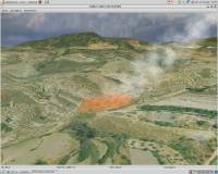 [ Zoom screenshot ] |
|
| Software Info | |
|
Best Vista Download periodically updates pricing and software information of Virtual Terrain Project for Windows full version from the publisher,
but some information may be out-of-date. You should confirm all information. Software piracy is theft, using crack, warez passwords, patches, serial numbers, registration codes, key generator, keymaker or keygen for Virtual Terrain Project for Windows license key is illegal and prevent future development of Virtual Terrain Project for Windows. Download links are directly from our mirrors or publisher's website, Virtual Terrain Project for Windows torrent files or shared files from rapidshare, yousendit or megaupload are not allowed! |
|
| Released: | September 08, 2011 |
| Filesize: | 1.00 MB |
| Platform: | Windows 2000, Windows 2003, Windows XP, Windows Vista |
| Install | Instal And Uninstall |
| Add Your Review or Windows Vista Compatibility Report |
Virtual Terrain Project for Windows- Releases History |
| Software: | Virtual Terrain Project for Windows 1.1 110804 |
| Date Released: | Sep 8, 2011 |
| Status: | New Release |
| Release Notes: | Enviro: Exposed support for more stereo modes: Horizontal and Vertical split. Options to enable joystick and spacenavigator, rather than just always using them if present. Smooth continuous update when making buildings. Option to constrain building point to right angles. Deter user from making bad points. Made support for Collada (.dae) more explicit in the UI. Display the version number in the startup dialog. Added 'every N meters' option to Contour dialog, making it significantly more useful. Changed 'Move' mode to use Alt modifier key for up/down, to be consistent. Fixed issues with: support for elevation grids with non-unit vertical scale; removing layers from a terrain; saving snapshot and high-resolution snapshot; buildings with a Geographic CRS; draping of 2D polylines on terrain with vertical exaggeration. VTBuilder: Raw layers: Draw polygon holes as dotted lines to tell them from outer edges. |
Most popular form in CAD downloads for Vista |
|
GPS Utility 5.51 download by GPS Utility Ltd.
... in PC files in one of several text formats. The program converts between different map datums and many coordinate formats (Lat/Long, UTM/UPS, country grids etc.). Information can be ... and add map annotations in text or image form. GPS Utility can also be set to ...
type: Demo ($60.00)
View Details
Download
categories: Waypoint Manager, GPS Receiver, Digitise GPS, Waypoint, GPD, Digitise |
 |
|
Pro Yacht 1.0.0.1 download by Marcus Bole
... For the expert designer, the native text file format can be used to overlay flow lines and ... developments which were created to support the hull form transformation process. The primary focus has been the ...
type: Freeware
View Details
Download
categories: calculate hydrostatic coefficient, ship displacement, design ship hull, ship, design, create |
 |
|
GoNest Profile 2014 download by XY Soft.
... acrylics etc. Whether your stock is in the form of Sheets or Coils (rolls), once you define your nesting job, the layout software requires just one mouse click to arrange ...
type: Trialware ($699.00)
View Details
Download
categories: Sheet Cutting, Optimize Layout, Reduce Scrap, Cutter, Optimize, Rectangular Cut |
 |
|
SolveDiffEq 3.6.0.0 download by Bob Delaney
... any number of coupled differential equations of the form dx(0)/dt = f(0)(t, x(0), x(1), . . .) dx(1)/dt = f(1)(t, x(0), x(1), . . . ) . . . ...
type: Freeware
View Details
Download
categories: solve differential equation, differential equation, equation solver, Solve, Equation, Differential |
|
TNTatlas 2024 B20240606 download by MicroImages, Inc.
... sized geodata and will directly display numerous file formats including shapefiles, GeoTIFF, JP2, PNG, MrSID, DXF, and ... to a wide audience in an easily used form. You may be responsible for the distribution of ...
type: Freeware
View Details
Download
categories: geospatial viewer, view atlas, visualize geospatial data, atlas, map, viewer |
 |
|
VirtualBreadboard 6.0.8/1.7.2 download by James Caska
... general term in electronics, referring more to the form of a circuit rather than its functionality, describing the construction base for electronics prototypes. VBB simulates many of the PIC16 ...
type: Freeware
View Details
Download
categories: simulation environment, development environment, design simulator, simulation, simulate, development |
 |
|
ITALASSI 1.2 download by Kovach Computing Services
... additive, and one multivariate with interaction) in the form of equations or compute those equations from raw data and displays the various models using 2D and 3D graphs. The program ...
type: Freeware
View Details
Download
categories: regression model, interpretation model, graph generator, regression, graph, analyzer |
 |
|
Prode Valves 1.08 download by Prode
... both spreadsheet mode (with capability of full editing) form view and graph view. * Access to a ... Lift. * Flow rate vs. Control variable. Form View Prode Valves supports three data viewing ...
type: Freeware
View Details
Download
categories: design valve, create safety valve, valve quotation, design, create, valve |
 |
|
MOPlot 1.93 download by Sourceforge
... vibrations, both as displacement vectors and in animated form. For complex molecules where the calculation of the ... be displayed and saved to a file. · Form linear combinations of vibrations. This feature is useful ...
type: Freeware
View Details
Download
categories: molecular orbital plotting, compute geometric parameters, molecular orbitals, visualization, molecule, orbital |
 |
|
VeeCAD 2.39 Release 1 download by Roger Lascelles
... stretch. Break tracks, add wire links and free form wiring. Use almost any schematic editor. Learn quickly ... process. Copy images to the clipboard in bitmap format to any desired scale, for use on website ...
View Details
Download
|
 |