Related Keywords
geographic coordinates downloadscoordinates downloads
coordinates conversion downloads
coordinates conversions downloads
geographic information system downloads
geographic downloads
geographic marketi downloads
geographic targeting downloads
geographic information systems downloads
geographic coordinate system downloads
geographic quiz downloads
geographic area downloads
geographic information downloads
geographic software downloads
geographic data viewer downloads
geographic data downloads
geographic database object downloads
geographic exploration downloads
view all coordinates downloads
spherical coordinates downloads
Top Software Keywords
autocad downloadscad downloads
3d cad downloads
drawing downloads
import downloads
design downloads
dwg downloads
pdf to dwg downloads
dxf downloads
convert downloads
convert pdf to dwg downloads
dwg to pdf downloads
converter downloads
dxf to pdf downloads
pdf to dxf downloads
dwg to dxf downloads
dwf to dwg downloads
dwg converter downloads
dwg to jpg downloads
dwg to bmp downloads
stl downloads
dxf to pcl downloads
dwg to tiff downloads
intellicad downloads
pdf to cad downloads
dwg to gif downloads
convert dwg to pdf downloads
dwg to png downloads
dwg to dwf downloads
dxf to ps downloads
Vista Download
Vista downloadVista antivirus download
Vista wallpaper download
Vista wallpapers download
Vista themes download
Vista pack download
Vista ultimate download
Vista home download
Vista basic download
Vista business download
Vista x64 download
Vista transformation download
Vista transformation pack download
Vista boot download
Vista dvd download
Vista sidebar download
Vista aero download
Vista product key download
Downloads RSS
Top Downloads
Top Rated
Navigation: Home
\ Graphic Apps
\ CAD \ TNTmips
TNTmips20240404 by MicroImages, Inc. |

|
Software Description:
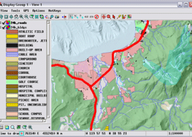
TNTmips is a geospatial image processing tool that allows you to analyze and modify GIS images. It is a professional application that can handle desktop cartography, electronic atlas preparation and spatial database management. ...
type: Freeware
Download TNTmipscategories: GIS data analysis, analyze geodetic data, edit GIS dataset, GIS, dataset, editor, analysis Add to Download Basket Report virus or spyware |
 [ Zoom screenshot ] |
|
| Software Info | |
|
Best Vista Download periodically updates pricing and software information of TNTmips full version from the publisher,
but some information may be out-of-date. You should confirm all information. Software piracy is theft, using crack, warez passwords, patches, serial numbers, registration codes, key generator, keymaker or keygen for TNTmips license key is illegal and prevent future development of TNTmips. Download links are directly from our mirrors or publisher's website, TNTmips torrent files or shared files from rapidshare, yousendit or megaupload are not allowed! |
|
| Released: | April 04, 2024 |
| Filesize: | 121.00 MB |
| Platform: | Windows XP, Windows Vista, Windows Vista x64, Windows 7, Windows 7 x64, Windows 8, Windows 8 x64, Windows 10, Windows 10 x64, Windows 11 |
| Install | Instal And Uninstall |
| Add Your Review or Windows Vista Compatibility Report |
TNTmips- Releases History |
| Software: | TNTmips 20240404 |
| Date Released: | Apr 4, 2024 |
| Status: | New Release |
| Software: | TNTmips 20240131 |
| Date Released: | Jan 31, 2024 |
| Status: | New Release |
| Software: | TNTmips 20240108 |
| Date Released: | Jan 8, 2024 |
| Status: | New Release |
Most popular geographic coordinates in CAD downloads for Vista |
|
TNTmips 20240404 download by MicroImages, Inc.
TNTmips software is a complete Geographic Information System (GIS) that lets you work with ... using a reference image; place control points with coordinates from GPS devices ... Import and export ...
type: Freeware
View Details
Download
categories: GIS data analysis, analyze geodetic data, edit GIS dataset, GIS, dataset, editor, analysis |
 |