Related Keywords
gis downloadsgis technology downloads
gis map downloads
gis mapping software downloads
gis sdk downloads
gis software downloads
gis translator downloads
gis convertor downloads
gis calculator downloads
gis icons downloads
gis maps downloads
gis data downloads
gis editor downloads
gis viewer downloads
gis imagery downloads
gis analysis downloads
gis designer downloads
gis catalog downloads
gis map management downloads
gis library downloads
Top Software Keywords
autocad downloadscad downloads
3d cad downloads
drawing downloads
import downloads
design downloads
dwg downloads
dxf downloads
pdf to dwg downloads
convert downloads
convert pdf to dwg downloads
dwg to pdf downloads
converter downloads
dxf to pdf downloads
dwg to dxf downloads
pdf to dxf downloads
dwf to dwg downloads
dwg converter downloads
dwg to jpg downloads
dwg to bmp downloads
stl downloads
dxf to pcl downloads
dwg to tiff downloads
intellicad downloads
pdf to cad downloads
dwg to gif downloads
convert dwg to pdf downloads
dwg to png downloads
dwg to dwf downloads
dxf to ps downloads
Vista Download
Vista downloadVista antivirus download
Vista wallpaper download
Vista wallpapers download
Vista themes download
Vista pack download
Vista ultimate download
Vista home download
Vista basic download
Vista business download
Vista x64 download
Vista transformation download
Vista transformation pack download
Vista boot download
Vista dvd download
Vista sidebar download
Vista aero download
Vista product key download
Downloads RSS
Top Downloads
Top Rated
Navigation: Home
\ Graphic Apps
\ CAD \ wxGIS
wxGIS0.2.0 by Dmitry Barishnikov |

|
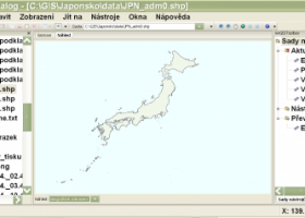
Software Description:
wxGIS is a useful application that allows you to manage and to organize multiple types of geographic information. The program has an Explorer-like interface that is able to store the geographic coordinate systems in folders. It also includes a vector file export utility and a tool for correcting the orthographic data from raster TIFF files. ...
type: Open Source
Download wxGIScategories: GIS catalog, manage geography data, geographic coordinate system, manage, catalog, geography Add to Download Basket Report virus or spyware |
 [ Zoom screenshot ] |
|
| Software Info | |
|
Best Vista Download periodically updates pricing and software information of wxGIS full version from the publisher,
but some information may be out-of-date. You should confirm all information. Software piracy is theft, using crack, warez passwords, patches, serial numbers, registration codes, key generator, keymaker or keygen for wxGIS license key is illegal and prevent future development of wxGIS. Download links are directly from our mirrors or publisher's website, wxGIS torrent files or shared files from rapidshare, yousendit or megaupload are not allowed! |
|
| Released: | November 15, 2012 |
| Filesize: | 9.70 MB |
| Platform: | Windows XP, Windows Vista, Windows Vista x64, Windows 7, Windows 7 x64 |
| Install | Instal And Uninstall |
| Add Your Review or Windows Vista Compatibility Report |
wxGIS- Releases History |
| Software: | wxGIS 0.2.0 |
| Date Released: | Nov 15, 2012 |
| Status: | New Release |
| Release Notes: | · The DEM interpolation switch (bilinear or cubic) in orthocorrect tool · Russian interface translation · Rename item support · Automatic rename output files in batch export · The ortho-correction tool become more accurate and speedy |
Most popular gis in CAD downloads for Vista |
|
Woodland Potential Calculator 2.01 download by Michell Computing
Woodland Potential Calculator was specially developed as a data collection and presentation instrument. It is designed to calculate the potential for increasing the extent of tree cover across the north ...
type: Open Source
View Details
Download
categories: calculate potential, tree cover, potential calculation, calculator, potential, tree |
 |
|
Elshayal Smart 23.02 download by Elshayal Smart Web On Line Software
Elshayal Smart is the first Arabian GIS software that is completely developed by Arabian developers team and independent of any commercial software package. Download Maps from Google Earth, and ...
View Details
Download
|
 |
|
TNTmips 20240404 download by MicroImages, Inc.
... Spatial, DGN, TAB, DXF, DWG ... Full-featured GIS that integrates imagery along with geometric data including vector, CAD, shape, pinmap, and TIN formats. Maintain relational database attributes for vector, ...
type: Freeware
View Details
Download
categories: GIS data analysis, analyze geodetic data, edit GIS dataset, GIS, dataset, editor, analysis |
 |
|
Thuban for Windows 1.2.2 download by Thuban Development Team
... FreeGIS Project provides an overview of Free Software GIS projects. Many valuable and highly sophisticated tools exist, ... information. Thuban makes use of several Free GIS Software components and is itself the basis of ...
type: Open Source
View Details
Download
categories: geographic data viewer, gis viewer, analyze geographic information, information, geographic, viewer |
 |
|
FlashPoints 3.0 download by DeliCAD
FlashPoints is a tool for creating and managing points Groups (topographic points for example). FlashPoints allows you to : * import/export points coordinates from and to a file * create points ...
type: Demo ($70.00)
View Details
Download
categories: autocad, cad, dxf, xls, excel, gps, xyz, nxyz, points, import, cogo, survey, coordinates, gis, topography |
 |
|
IrriPro 3.1 download by Irriworks
... as objects containing hydraulic characteristics, geometries, materials and GIS informations obtained by Google Earth. Thanks to IrriPro's innovative technology it's now possible to calculate all the hydraulic parameters and design ...
View Details
Download
|
 |
|
GHydraulics 2.1.8 download by Steffen Macke
GHydraulics is a Quantum GIS plugin that allows to export water supply networks ... flowrates. The functions are accessible from the Quantum GIS plugin menu and toolbars.
type: Open Source
View Details
Download
categories: Quantum GIS plugin, water supply network, pipe diameter, plugin, Quantum GIS, calculate |
 |
|
wxGIS Portable 0.4.1 download by Dmitry Barishnikov
wxGIS is a useful application that allows you to manage and to organize multiple types of geographic information. The program has an Explorer-like interface that is able to store the geographic ...
type: Open Source
View Details
Download
categories: GIS catalog, manage geography data, geographic coordinate system, manage, catalog, geography |
 |
|
JMARS for Windows 3.1.5 download by Arizona State University
JMARS is an acronym that stands for Java Mission-planning and Analysis for Remote Sensing. It is a geospatial information system (GIS) developed by ASU's Mars Space Flight Facility to provide mission ...
type: Freeware
View Details
Download
categories: mission analysis, geospatial information, GIS analysis, mission, analysis, GIS |
 |
|
ArcReader 10.5.0 B6491 download by ESRI
... that was once limited to those with advanced GIS software on their computers. With ArcReader, you ... ArcGIS maps using ArcReader (.pmf files). Deploy your GIS data to novices and professionals alike. Zoom, pan, ...
View Details
Download
|
 |