Related Keywords
project tools downloadsproject management tools downloads
project manage tools downloads
tools for project managers downloads
project downloads
project time tracking downloads
project managment downloads
project management downloads
project manager downloads
project tracking downloads
project tracking software downloads
project mangement software downloads
project time downloads
project cost downloads
project management software downloads
project management tool downloads
project management solution downloads
project management system downloads
project management program downloads
project planning software downloads
Top Software Keywords
autocad downloadscad downloads
3d cad downloads
drawing downloads
import downloads
design downloads
dwg downloads
pdf to dwg downloads
dxf downloads
convert downloads
convert pdf to dwg downloads
dwg to pdf downloads
converter downloads
dxf to pdf downloads
dwg to dxf downloads
pdf to dxf downloads
dwf to dwg downloads
dwg to jpg downloads
dwg converter downloads
dwg to bmp downloads
stl downloads
dxf to pcl downloads
dwg to tiff downloads
intellicad downloads
pdf to cad downloads
dwg to gif downloads
convert dwg to pdf downloads
dwg to png downloads
dwg to dwf downloads
dxf to ps downloads
Vista Download
Vista downloadVista antivirus download
Vista wallpaper download
Vista wallpapers download
Vista themes download
Vista pack download
Vista ultimate download
Vista home download
Vista basic download
Vista business download
Vista x64 download
Vista transformation download
Vista transformation pack download
Vista boot download
Vista dvd download
Vista sidebar download
Vista aero download
Vista product key download
Downloads RSS
Top Downloads
Top Rated
Navigation: Home
\ Graphic Apps
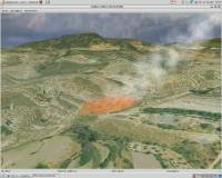
\ CAD \ Virtual Terrain Project for Windows
Virtual Terrain Project for Windows1.1 110804 by Ben Discoe |

|
Software Description:
... of VTP is to foster the creation of tools for easily constructing any part of the real world in interactive, 3D digital form.This goal will require a synergetic convergence of the fields of CAD, GIS, visual simulation, surveying and remote sensing. VTP gathers information and tracks progress in areas such as procedural scene construction, feature extraction, and rendering algorithms. ...
type: Open Source
Download Virtual Terrain Project for Windowscategories: libraries, demos, data, open source, VirtualTerrain Project, CAD, GIS, VTP Add to Download Basket Report virus or spyware |
 [ Zoom screenshot ] |
|
| Software Info | |
|
Best Vista Download periodically updates pricing and software information of Virtual Terrain Project for Windows full version from the publisher,
but some information may be out-of-date. You should confirm all information. Software piracy is theft, using crack, warez passwords, patches, serial numbers, registration codes, key generator, keymaker or keygen for Virtual Terrain Project for Windows license key is illegal and prevent future development of Virtual Terrain Project for Windows. Download links are directly from our mirrors or publisher's website, Virtual Terrain Project for Windows torrent files or shared files from rapidshare, yousendit or megaupload are not allowed! |
|
| Released: | September 08, 2011 |
| Filesize: | 1.00 MB |
| Platform: | Windows 2000, Windows 2003, Windows XP, Windows Vista |
| Install | Instal And Uninstall |
| Add Your Review or Windows Vista Compatibility Report |
Virtual Terrain Project for Windows- Releases History |
| Software: | Virtual Terrain Project for Windows 1.1 110804 |
| Date Released: | Sep 8, 2011 |
| Status: | New Release |
| Release Notes: | Enviro: Exposed support for more stereo modes: Horizontal and Vertical split. Options to enable joystick and spacenavigator, rather than just always using them if present. Smooth continuous update when making buildings. Option to constrain building point to right angles. Deter user from making bad points. Made support for Collada (.dae) more explicit in the UI. Display the version number in the startup dialog. Added 'every N meters' option to Contour dialog, making it significantly more useful. Changed 'Move' mode to use Alt modifier key for up/down, to be consistent. Fixed issues with: support for elevation grids with non-unit vertical scale; removing layers from a terrain; saving snapshot and high-resolution snapshot; buildings with a Geographic CRS; draping of 2D polylines on terrain with vertical exaggeration. VTBuilder: Raw layers: Draw polygon holes as dotted lines to tell them from outer edges. |
Most popular project tools in CAD downloads for Vista |
|
3D Home Design by Livecad 3.1 download by Livecad
... standards, whilst benefitting from a range of professional tools to design, display, present and realise all your building projects! In this brand new 3.1 version, discover an ... an interior work wizard, materials manager, a smart project browser, and a catalogue with an even more ...
View Details
Download
|
 |
|
CurveExpert Professional 2.7.3 download by Daniel G. Hyams
... determination. Validated: validated against the Statistical Reference Datasets Project of the National Institute of Standards and Technology. ... modify it with a suite of data transformation tools. ...
View Details
Download
|
 |
|
3D Architecture by LiveCAD 2.1 download by LiveCAD Technologies
... textures and materials to all elements of your project - Personalise the placing of wall and floor ... 3D tour - Use a range of advanced tools to modify the land area - Automatic roof ...
View Details
Download
|
 |
|
DataCAD 20.03.00.04 download by DATACAD LLC.
... architects and software engineers for architecture, DataCAD includes tools that make design and drafting easier, such as ... DataCAD includes automated 3D modeling, and photorealistic rendering tools that put you ahead of the competition. You ...
type: Trialware ($1 295.00)
View Details
Download
categories: cad tool, architectural design, construction creation, CAD, architect, creation |
 |
|
VideoCAD Lite 8.2.0.0 download by CCTVCAD Software
... VideoCAD_Lite offers only the most useful and easy-to-master tools for CCTV design. VideoCAD Lite will help you ... parameters of view areas. * Calculate the horizontal projection sizes of view areas to draw them on ...
type: Trialware ($350.00)
View Details
Download
categories: develop CCTV, design CCTV, video surveillance designer, CAD, surveillance, design |
 |
|
Gephi 0.10.1 download by Mathieu Bastian
... Iterate through visualization using dynamic filtering · Rich tools for meaningful graph manipulation Layout: · Layout ... work in workspaces and save their session .gephi project files. · Save/Load project files · Use the ...
type: Open Source
View Details
Download
categories: interactive visualization, exploration platform, visualization platform, visualization, exploration, graph |
 |
|
VideoCAD Starter 7.0 download by CCTVCAD Software
... of computer resources because of absence of resource-intensive tools. VideoCAD Starter is registered only by personal registration ... required parameters of view areas. Calculate the horizontal projection sizes of view areas to draw them on ...
type: Demo ($85.00)
View Details
Download
categories: CCTV design, CCTV system, video surveillance, camera, lens, focal length, field of view, IP camera, megapixel, camera resolution, lens calculator, cctv calculator, field of view calculator, camera calculator, 3D CCTV |
 |
|
MuniWin 2.1.13 download by David Motl
... simple and intuitive graphical user interface. The project follows up with the Munipack package, the programs and tools have the same name, but in difference to ... of the command-line parameters is similar in both projects, the exceptions are described in the documentation. ...
type: Open Source
View Details
Download
categories: image reduction, astrophotometry tool, CCD camera, reduce, reduction, astrophotometry |
 |
|
Ctrax 0.5.19b download by Caltech Ethomics Project
... freely moving flies. Our primary goal in this project is to provide quantitative behavior analysis tools to the neuroethology community, thus we've endeavored to ...
type: Open Source
View Details
Download
categories: walking fly tracker, fly behavior analysis, fly monitor, fly, tracker, fly behavior |
 |
|
Thuban for Windows 1.2.2 download by Thuban Development Team
... and Classification # Table Queries and Joins # Projection Support # Printing and Vector Export # API ... is Thuban being developed? [2001:] The FreeGIS Project provides an overview of Free Software GIS projects. ...
type: Open Source
View Details
Download
categories: geographic data viewer, gis viewer, analyze geographic information, information, geographic, viewer |
 |