Related Keywords
raster image downloadsraster image processor downloads
raster image viewer downloads
raster image georeferencing downloads
raster image x64 downloads
plot raster image downloads
analyze raster image downloads
plot raster image x64 downloads
digitize raster image downloads
x64 digitize raster image downloads
raster print downloads
raster downloads
raster printer driver downloads
raster to vector downloads
raster to vector software downloads
raster vectorization downloads
raster to vector conversion downloads
raster to vector converter sdk downloads
raster layers downloads
raster editor downloads
Top Software Keywords
autocad downloadscad downloads
3d cad downloads
drawing downloads
import downloads
design downloads
dwg downloads
dxf downloads
pdf to dwg downloads
convert downloads
convert pdf to dwg downloads
dwg to pdf downloads
converter downloads
dxf to pdf downloads
dwg to dxf downloads
pdf to dxf downloads
dwf to dwg downloads
dwg to jpg downloads
dwg converter downloads
dwg to bmp downloads
stl downloads
dxf to pcl downloads
dwg to tiff downloads
intellicad downloads
pdf to cad downloads
dwg to gif downloads
convert dwg to pdf downloads
dwg to png downloads
dwg to dwf downloads
dxf to ps downloads
Vista Download
Vista downloadVista antivirus download
Vista wallpaper download
Vista wallpapers download
Vista themes download
Vista pack download
Vista ultimate download
Vista home download
Vista basic download
Vista business download
Vista x64 download
Vista transformation download
Vista transformation pack download
Vista boot download
Vista dvd download
Vista sidebar download
Vista aero download
Vista product key download
Downloads RSS
Top Downloads
Top Rated
Navigation: Home
\ Graphic Apps
\ CAD \ TopoLT
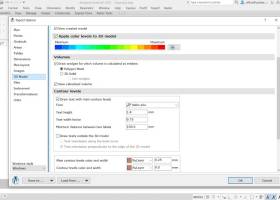
TopoLT15.2 by CADWARE Engineering |

|
Software Description:
... models and contours, fill and cut volumes calculation, raster image georeferencing and automatic printing. 3D model of the terrain and contour lines can be generated, volumes can be calculated without any restrictions. ...
type: Trialware ($600.00)
Download TopoLTcategories: topographical plan, cadastral plan, terrain model, topography, cadaster, terrain Add to Download Basket Report virus or spyware |
 [ Zoom screenshot ] |
|
| Software Info | |
|
Best Vista Download periodically updates pricing and software information of TopoLT full version from the publisher,
but some information may be out-of-date. You should confirm all information. Software piracy is theft, using crack, warez passwords, patches, serial numbers, registration codes, key generator, keymaker or keygen for TopoLT license key is illegal and prevent future development of TopoLT. Download links are directly from our mirrors or publisher's website, TopoLT torrent files or shared files from rapidshare, yousendit or megaupload are not allowed! |
|
| Released: | October 16, 2023 |
| Filesize: | 67.80 MB |
| Platform: | Windows XP, Windows Vista, Windows Vista x64, Windows 7, Windows 7 x64, Windows 8, Windows 8 x64, Windows 10, Windows 10 x64, Windows 11 |
| Install | Instal And Uninstall |
| Add Your Review or Windows Vista Compatibility Report |
TopoLT- Releases History |
| Software: | TopoLT 15.2 |
| Date Released: | Oct 16, 2023 |
| Status: | New Release |
| Software: | TopoLT 15.1 |
| Date Released: | Mar 3, 2023 |
| Status: | New Release |
| Software: | TopoLT 14.0 |
| Date Released: | Feb 24, 2022 |
| Status: | New Release |
Most popular raster image in CAD downloads for Vista |
|
Gerbview x64 10.21 download by Software Companions
... convert and markup Gerber, HPGL, HPGL/2, Excellon and raster files. GerbView x64 supports both RS274D and RS274X ... of supported formats below. GerbView x64 can rasterize single files, or whole workspaces, and save to ...
type: Trialware ($80.00)
View Details
Download
categories: x64 print Gerber image, view plot x64, convert Gerber x64, convert x64, Gerber x64, print x64 |
 |
|
TNTmips 20240404 download by MicroImages, Inc.
... with virtually any type of geospatial data including imagery, terrain surfaces, and map data with associated database ... without importing. Overlay your geodata on Bing Maps imagery and maps or on geodata layers published on ...
type: Freeware
View Details
Download
categories: GIS data analysis, analyze geodetic data, edit GIS dataset, GIS, dataset, editor, analysis |
 |
|
Elshayal Smart 23.02 download by Elshayal Smart Web On Line Software
... & save GPS route and View and Rectify Raster Images gif, jpg, bmp and Edit shape files, build ... network, find shortest path, print map, save map image, copy map image to clipboard, save project map, ...
View Details
Download
|
 |
|
VisualART 1.0.2.1 download by MecSoft Corporation
... new modeling techniques for modeling artistic shapes using raster bitmap images. Used in conjunction with VisualCAM's 3D modeling tools, ... model making. Features: 3D Relief from image files (jpg, gif, bmp) Ability to limit ...
type: Demo ($19.90)
View Details
Download
categories: create 3D relief, geometric shape converter, VisualCAM plug-in, create, creator, convert |
 |
|
Panoply 5.4.3 download by Robert B. Schmunk
... application whose purpose is to help you plot raster images. It lets you view photos created with NetCDF, ... software application that helps you plot and analyze raster images of geo-gridded data from NetCDF and other ...
type: Freeware
View Details
Download
categories: plot raster image, longitude image, pole-to-pole image, raster image, rasterize, raster |
 |
|
CADopia 23 Professional 22.3.1.4100 download by CADopia
... DWF files for viewing drawings on the Internet Raster Image insertion and editing Clipping support for references, images, and viewports Quick input Annotation scaling Pattern hatch ...
type: Demo ($745.00)
View Details
Download
categories: corelcad, autocad, intellicad, bricscad, progecad, draftsight, zwcad, ARES Commander, dwg viewer, drawing viewer, drawing, dxf, dwg, survey, CAD, drafting, BIM, Revit, fusion 360 |
 |
|
TopoLT 15.2 download by CADWARE Engineering
... models and contours, fill and cut volumes calculation, raster image georeferencing and automatic printing. TopoLT is running on ... movies can be saved with moving three-dimensional objects, images can be saved, 3ds files can be visualized, ...
type: Trialware ($600.00)
View Details
Download
categories: topographical plan, cadastral plan, terrain model, topography, cadaster, terrain |
 |
|
R2V 3.66 download by MR Soft
R2V is a tool for converting raster images to vector by drawing centerlines and outlines. R2V ... various technical drawings, maps and other types from raster to vector format. A vector format can be ...
type: Shareware ($42.00)
View Details
Download
categories: vector, r2v, vectorize, cnc, photo, engraving, bmp, hobby, carving, mill, cad, cam, stl, image, hpgl, dxf, raster, grayscale, conversion, g-code |
 |
|
BabaCAD 2.0.0 download by Mirza Coralic
... circle, arc, hatch with patterns, text, block, dimension, image Fast access to blocks using Block Explorer ... widths by block or by layer Insert images of standard image formats (jpg, bmp, gif,...) ...
View Details
Download
|
 |
|
GstarCAD 2021 Professional download by Gstarsoft Co.,Ltd.
... significant improvements in Tool Palette, Mtext Editor and raster image display, ...
View Details
Download
|
 |