Related Keywords
raster to vector downloadsraster to vector software downloads
raster to vector conversion downloads
raster to vector converter sdk downloads
raster to vector sdk downloads
raster to vector convert downloads
raster to vector converter downloads
convert raster to vector downloads
raster to ps downloads
raster to emf downloads
image to vector downloads
pdf to vector downloads
bitmap to vector downloads
gif to vector downloads
jpg to vector downloads
pbm to vector downloads
xps to vector downloads
scan to vector downloads
ttf to vector downloads
truetype to vector downloads
Top Software Keywords
autocad downloadscad downloads
3d cad downloads
drawing downloads
import downloads
design downloads
dwg downloads
pdf to dwg downloads
dxf downloads
convert downloads
convert pdf to dwg downloads
dwg to pdf downloads
converter downloads
dxf to pdf downloads
pdf to dxf downloads
dwf to dwg downloads
dwg to dxf downloads
dwg converter downloads
dwg to jpg downloads
dwg to bmp downloads
stl downloads
dxf to pcl downloads
dwg to tiff downloads
intellicad downloads
pdf to cad downloads
dwg to gif downloads
convert dwg to pdf downloads
dwg to png downloads
dwg to dwf downloads
dxf to ps downloads
Vista Download
Vista downloadVista antivirus download
Vista wallpaper download
Vista wallpapers download
Vista themes download
Vista pack download
Vista ultimate download
Vista home download
Vista basic download
Vista business download
Vista x64 download
Vista transformation download
Vista transformation pack download
Vista boot download
Vista dvd download
Vista sidebar download
Vista aero download
Vista product key download
Downloads RSS
Top Downloads
Top Rated
Navigation: Home
\ Graphic Apps
\ CAD \ wxGIS
wxGIS0.2.0 by Dmitry Barishnikov |

|
Software Description:
... coordinate systems in folders. It also includes a vector file export utility and a tool for correcting the orthographic data from raster TIFF files. ...
type: Open Source
Download wxGIScategories: GIS catalog, manage geography data, geographic coordinate system, manage, catalog, geography Add to Download Basket Report virus or spyware |
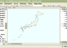 [ Zoom screenshot ] |
|
| Software Info | |
|
Best Vista Download periodically updates pricing and software information of wxGIS full version from the publisher,
but some information may be out-of-date. You should confirm all information. Software piracy is theft, using crack, warez passwords, patches, serial numbers, registration codes, key generator, keymaker or keygen for wxGIS license key is illegal and prevent future development of wxGIS. Download links are directly from our mirrors or publisher's website, wxGIS torrent files or shared files from rapidshare, yousendit or megaupload are not allowed! |
|
| Released: | November 15, 2012 |
| Filesize: | 9.70 MB |
| Platform: | Windows XP, Windows Vista, Windows Vista x64, Windows 7, Windows 7 x64 |
| Install | Instal And Uninstall |
| Add Your Review or Windows Vista Compatibility Report |
wxGIS- Releases History |
| Software: | wxGIS 0.2.0 |
| Date Released: | Nov 15, 2012 |
| Status: | New Release |
| Release Notes: | · The DEM interpolation switch (bilinear or cubic) in orthocorrect tool · Russian interface translation · Rename item support · Automatic rename output files in batch export · The ortho-correction tool become more accurate and speedy |
Most popular raster to vector in CAD downloads for Vista |
|
RhinoART 1.0.0.0 download by MecSoft Corporation
... new modeling techniques for modeling artistic shapes using raster bitmap images. Used in conjunction with Rhino's 3D modeling tools, it offers a complementary set of modeling techniques for jewelry design, ...
type: Demo
View Details
Download
categories: Rhinoceros plug-in, create relief shape, vector curve creator, create, creator, shape |
 |
|
SCaVis 2.3 download by Dr. Sergei Chekanov
... function visualization. All plots can be exported to raster formats (PDF, PNG, JPG, etc.) and high-quality vector formats (PostScript, EPS) ready to be included into ...
type: Freeware
View Details
Download
categories: data-analysis framework, data manipulation, data plotting, analyze, analysis, analyzer |
 |
|
TNTmips 20240404 download by MicroImages, Inc.
... Import and export an unsurpassed number of raster, geometric, and database file formats; convert between data ... that integrates imagery along with geometric data including vector, CAD, shape, pinmap, and TIN formats. Maintain relational ...
type: Freeware
View Details
Download
categories: GIS data analysis, analyze geodetic data, edit GIS dataset, GIS, dataset, editor, analysis |
 |
|
R2V 3.66 download by MR Soft
R2V is a tool for converting raster images to vector by drawing centerlines and outlines. R2V converts architect, ... various technical drawings, maps and other types from raster to vector format. A vector format can be ...
type: Shareware ($42.00)
View Details
Download
categories: vector, r2v, vectorize, cnc, photo, engraving, bmp, hobby, carving, mill, cad, cam, stl, image, hpgl, dxf, raster, grayscale, conversion, g-code |
 |
|
ShareCAD 2.0 download by CADSoftTools
... CAD formats: AutoCAD DWG, DXF, DWF, HPGL, PLT; Vector formats: PDF, SVG, EMF, WMF, CGM; 3D formats: STEP, STP, IGES, IGS, BREP, STL, SAT (ACIS); Raster formats: PNG, BMP, JPG, GIF, TIFF, TGA, CAL; ...
type: Freeware
View Details
Download
categories: Sharecad, online viewer, free viewer, DWG viewer, free online viewer, CAD viewer, 2D viewer, 3D viewer, view DWG, iframe plugin, DWG, DXF, STEP, STP, IGES, IGS, STL, PDF, HPGL, PLT, CGM, SVG, EMF, WMF, PNG, JPEG |
 |
|
Thuban for Windows 1.2.2 download by Thuban Development Team
... Data Viewer with the following features: # Vector Data Support: Shapefile, PostGIS Layer and OGR # Raster Data Support: GeoTIFF Layer and GDAL # Comfortable ... and Joins # Projection Support # Printing and Vector Export # API for Add-Ons (Extensions) # Multi-Language ...
type: Open Source
View Details
Download
categories: geographic data viewer, gis viewer, analyze geographic information, information, geographic, viewer |
 |
|
jHepWork 3.9 download by Dr. Sergei Chekanov
... function visualization. All plots can be exported to raster formats (PDF, PNG, JPG, etc.) and high-quality vector formats (PostScript, EPS) ready to be included into ...
type: Freeware
View Details
Download
categories: data-analysis framework, data manipulation, data plotting, analyze, analysis, analyzer |
 |
|
BabaCAD 2.0.0 download by Mirza Coralic
... layers and blocks Draw and modify 2D vector objects like point, line, rectangle, polyline with arc ... (jpg, bmp, gif,...) Insert and manage georeferenced raster images (tif/tfw,jpg/jgw,bmp/bpw) Fast OpenGL graphics used for ...
View Details
Download
|
 |
|
wxGIS 0.2.0 download by Dmitry Barishnikov
... coordinate systems in folders. It also includes a vector file export utility and a tool for correcting the orthographic data from raster TIFF files.
type: Open Source
View Details
Download
categories: GIS catalog, manage geography data, geographic coordinate system, manage, catalog, geography |
 |
|
wxGIS Portable 0.4.1 download by Dmitry Barishnikov
... coordinate systems in folders. It also includes a vector file export utility and a tool for correcting the orthographic data from raster TIFF files.
type: Open Source
View Details
Download
categories: GIS catalog, manage geography data, geographic coordinate system, manage, catalog, geography |
 |