Related Keywords
surface map downloadssurface downloads
surface test downloads
surface scan downloads
surface mesh downloads
surface fitting downloads
surface area of the body downloads
surface textures downloads
surface plot downloads
surface modeler downloads
surface profile downloads
surface elevations downloads
surface analyzer downloads
surface rendering downloads
surface profilometer downloads
surface analysis downloads
surface based area calculation downloads
surface tab downloads
surface dist downloads
surface the soaring city downloads
Top Software Keywords
autocad downloadscad downloads
3d cad downloads
drawing downloads
import downloads
design downloads
dwg downloads
dxf downloads
pdf to dwg downloads
convert downloads
convert pdf to dwg downloads
dwg to pdf downloads
converter downloads
dxf to pdf downloads
dwg to dxf downloads
pdf to dxf downloads
dwf to dwg downloads
dwg to jpg downloads
dwg converter downloads
dwg to bmp downloads
stl downloads
dxf to pcl downloads
dwg to tiff downloads
intellicad downloads
pdf to cad downloads
dwg to gif downloads
convert dwg to pdf downloads
dwg to png downloads
dwg to dwf downloads
dxf to ps downloads
Vista Download
Vista downloadVista antivirus download
Vista wallpaper download
Vista wallpapers download
Vista themes download
Vista pack download
Vista ultimate download
Vista home download
Vista basic download
Vista business download
Vista x64 download
Vista transformation download
Vista transformation pack download
Vista boot download
Vista dvd download
Vista sidebar download
Vista aero download
Vista product key download
Downloads RSS
Top Downloads
Top Rated
Navigation: Home
\ Graphic Apps
\ CAD \ JMARS for Windows
JMARS for Windows3.1.5 by Arizona State University |

|
Software Description:
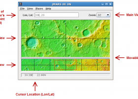
JMARS is an acronym that stands for Java Mission-planning and Analysis for Remote Sensing. It is a geospatial information system (GIS) developed by ASU's Mars Space Flight Facility to provide mission planning and data-analysis tools to NASA's orbiters, instrument team members, students of all ages, and the general public. ...
type: Freeware
Download JMARS for Windowscategories: mission analysis, geospatial information, GIS analysis, mission, analysis, GIS Add to Download Basket Report virus or spyware |
 [ Zoom screenshot ] |
|
| Software Info | |
|
Best Vista Download periodically updates pricing and software information of JMARS for Windows full version from the publisher,
but some information may be out-of-date. You should confirm all information. Software piracy is theft, using crack, warez passwords, patches, serial numbers, registration codes, key generator, keymaker or keygen for JMARS for Windows license key is illegal and prevent future development of JMARS for Windows. Download links are directly from our mirrors or publisher's website, JMARS for Windows torrent files or shared files from rapidshare, yousendit or megaupload are not allowed! |
|
| Released: | August 12, 2014 |
| Filesize: | 50.00 MB |
| Platform: | Windows Vista, Windows Vista x64, Windows 7, Windows 7 x64 |
| Install | Instal And Uninstall |
| Add Your Review or Windows Vista Compatibility Report |
JMARS for Windows- Releases History |
| Software: | JMARS for Windows 3.1.5 |
| Date Released: | Aug 12, 2014 |
| Status: | New Release |
| Release Notes: | - In JMARS, locate the "Options" tab at the top of the screen, click it - Click "Check for Updates" |
| Software: | JMARS for Windows 3.0.4 |
| Date Released: | Jun 7, 2013 |
| Status: | New Release |
| Release Notes: | - minor change that will allow users to use Body->reset layers to reset layers to JMARS default/startup state - minor bug fix in the interaction of the Main view and Panner views - accuracy of crater layer settings improved when saving crater layers as part of a saved session - more graceful error handling when loading a saved session - removed the ESRI option from the list for loading/saving in the shape layer. The Geo tools ESRI option is the replacement - a fix for a drawing issue in the TES layer on Mac OS X running Java 7 - lower right corner coordinates added to the high resolution export tool including new UI functionality for setting export height and width - update to how image corners (lat/lon) are specified in high resolution export - added CSV export and look and feel changes to the Investigate tool - improved communication between the Stamp Layer and backend databases - Add Layer UI look and feel improvements - ease of use changes to crater counting layer for small bodies |
Most popular surface map in CAD downloads for Vista |
|
Terra Excess 25.1217 download by Terra Excess Software
... points with elevation values and create a 'Main surface'. Once done, you should choose the interval and ... Generated contours can be used as a base map for designing and implementing various construction projects or ...
type: Shareware ($298.00)
View Details
Download
categories: land surveying, civil engineering, topographic, contour lines, contour map, triangulated irregular network, earthworks, volumetric, volume calculation, cut and fill, volumes, estimating volumes, survey points, CAD, DXF, quarries, tin surface |
 |
|
CueMol 2.2.3.442 download by BKR Laboratory
... density (CCP4, CNS , and BRIX format), MSMS surface data, and GRASP electrostatic potential map. ...
type: Freeware
View Details
Download
categories: view macromolecular structure, macromolecular structure visualization, visualize macromolecular structure, viewer, view, visualize |
 |
|
GetNexrad 4.4.2 download by Carson
... 0.5 dBZ long range higher resolution images. Goggle Map overlays, real-time surface observations, and a web browser sidebar for even ...
type: Freeware
View Details
Download
categories: extract rainfall amount, DBZ analysis, view radar rainfall, view, extract, rainfall |
 |
|
TNTmips 20240404 download by MicroImages, Inc.
... any type of geospatial data including imagery, terrain surfaces, and map data with associated database attributes. It provides all ... published on the Internet as web tilesets, Web Map Service (WMS), and ArcIMS ... Automatically generate ...
type: Freeware
View Details
Download
categories: GIS data analysis, analyze geodetic data, edit GIS dataset, GIS, dataset, editor, analysis |
 |
|
Multiwfn 3.7 download by sobereva
... Outputting properties in a line and plotting curve map. · Outputting properties in a plane and plotting graph. Supported graph types including filled-color map, contour map, relief map (with/without projection), gradient map, ...
type: Open Source
View Details
Download
categories: wavefunction analysis, topology analysis, molecular structure, analysis, analize, wavefunction |
 |
|
JMARS for Windows 3.1.5 download by Arizona State University
... registered multilayer image. * Make topographic profiles, extract surface temperatures (day or night), plot footprints and render ... Correlate mineral compositions with topographic data. * Combine surface roughness data with thermal inertia data. * Contour ...
type: Freeware
View Details
Download
categories: mission analysis, geospatial information, GIS analysis, mission, analysis, GIS |
 |
|
CARIS Easy View 4.2.13 download by CARIS
... inspect data from every angle using various visualization, surface draping and filtering techniques. While navigating through the data users can record fly-throughs and export the recordings as movie files. ...
View Details
Download
|
 |