Related Keywords
tools downloadstools shell extensions downloads
tools for reading downloads
tools suite for tweaking downloads
tools developer c downloads
tools available on the market downloads
tools for vista downloads
tools for excel tables downloads
tools multigraph downloads
tools for windows downloads
tools to open corrupted ppt downloads
tools for schools downloads
tools for craigslist downloads
tools for network monitoring downloads
tools for mysql downloads
tools for postgresql downloads
tools for the unemployed downloads
tools for journalists downloads
tools for project managers downloads
tools for netbook downloads
Top Software Keywords
autocad downloadscad downloads
3d cad downloads
drawing downloads
import downloads
design downloads
dwg downloads
pdf to dwg downloads
dxf downloads
convert downloads
convert pdf to dwg downloads
dwg to pdf downloads
converter downloads
dxf to pdf downloads
dwg to dxf downloads
pdf to dxf downloads
dwf to dwg downloads
dwg converter downloads
dwg to jpg downloads
dwg to bmp downloads
stl downloads
dxf to pcl downloads
dwg to tiff downloads
intellicad downloads
pdf to cad downloads
dwg to gif downloads
convert dwg to pdf downloads
dwg to png downloads
dwg to dwf downloads
dxf to ps downloads
Vista Download
Vista downloadVista antivirus download
Vista wallpaper download
Vista wallpapers download
Vista themes download
Vista pack download
Vista ultimate download
Vista home download
Vista basic download
Vista business download
Vista x64 download
Vista transformation download
Vista transformation pack download
Vista boot download
Vista dvd download
Vista sidebar download
Vista aero download
Vista product key download
Downloads RSS
Top Downloads
Top Rated
Navigation: Home
\ Graphic Apps
\ CAD \ Virtual Terrain Project for Windows
Virtual Terrain Project for Windows1.1 110804 by Ben Discoe |

|
Software Description:
... of VTP is to foster the creation of tools for easily constructing any part of the real world in interactive, 3D digital form.This goal will require a synergetic convergence of the fields of CAD, GIS, visual simulation, surveying and remote sensing. VTP gathers information and tracks progress in areas such as procedural scene construction, feature extraction, and rendering algorithms. ...
type: Open Source
Download Virtual Terrain Project for Windowscategories: libraries, demos, data, open source, VirtualTerrain Project, CAD, GIS, VTP Add to Download Basket Report virus or spyware |
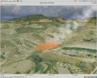 [ Zoom screenshot ] |
|
| Software Info | |
|
Best Vista Download periodically updates pricing and software information of Virtual Terrain Project for Windows full version from the publisher,
but some information may be out-of-date. You should confirm all information. Software piracy is theft, using crack, warez passwords, patches, serial numbers, registration codes, key generator, keymaker or keygen for Virtual Terrain Project for Windows license key is illegal and prevent future development of Virtual Terrain Project for Windows. Download links are directly from our mirrors or publisher's website, Virtual Terrain Project for Windows torrent files or shared files from rapidshare, yousendit or megaupload are not allowed! |
|
| Released: | September 08, 2011 |
| Filesize: | 1.00 MB |
| Platform: | Windows 2000, Windows 2003, Windows XP, Windows Vista |
| Install | Instal And Uninstall |
| Add Your Review or Windows Vista Compatibility Report |
Virtual Terrain Project for Windows- Releases History |
| Software: | Virtual Terrain Project for Windows 1.1 110804 |
| Date Released: | Sep 8, 2011 |
| Status: | New Release |
| Release Notes: | Enviro: Exposed support for more stereo modes: Horizontal and Vertical split. Options to enable joystick and spacenavigator, rather than just always using them if present. Smooth continuous update when making buildings. Option to constrain building point to right angles. Deter user from making bad points. Made support for Collada (.dae) more explicit in the UI. Display the version number in the startup dialog. Added 'every N meters' option to Contour dialog, making it significantly more useful. Changed 'Move' mode to use Alt modifier key for up/down, to be consistent. Fixed issues with: support for elevation grids with non-unit vertical scale; removing layers from a terrain; saving snapshot and high-resolution snapshot; buildings with a Geographic CRS; draping of 2D polylines on terrain with vertical exaggeration. VTBuilder: Raw layers: Draw polygon holes as dotted lines to tell them from outer edges. |
Most popular tools in CAD downloads for Vista |
|
VariCad 2010 3.03 download by VariCAD
... for mechanical engineering design. In addition to powerful tools for 3D modeling and 2D drafting and dimensioning, ... (ANSI, DIN), calculations of standard mechanical components, and tools for working with bills of materials (BOM) and ...
type: Trialware ($690.00)
View Details
Download
categories: mechanical engineering, 3d modelling tool, mechanical part, CAD, engineering, mechanical |
 |
|
Balancer Lite 2.1.0.448 download by Atangeo Ltd.
... to split the model into independent meshes in Tools | Options | Importers | Wavefront .obj. Balancer Lite can be used for non-commercial purposes in non-business, non-commercial environment only. ...
type: Freeware
View Details
Download
categories: 3D optimizer, optimize polygon count, optimize 3d model, optimizer, optimize, simplification |
 |
|
3D Home Design by Livecad 3.1 download by Livecad
... standards, whilst benefitting from a range of professional tools to design, display, present and realise all your ... 3D tour - Use a range of advanced tools to modify the land area - Automatic roof ...
View Details
Download
|
 |
|
MagicPlot Pro 2.9.3 download by MagicPlot.com
... Explore hidden details of your plot with navigation tools: Mouse wheel with Shift/Ctrl changes scale and scrolls. Hand tool is also available. Batch Processing The simplest way to process ...
type: Trialware ($198.00)
View Details
Download
categories: Nonlinear Fitting, Create Plot, customizable plot, Plotter, Plot, fitter |
 |
|
Volocity 64bit 6.5.1 download by PerkinElmer
... producing exceptional results. Volocity Restoration provides essential imaging tools for producing clarity and confidence in your images making them ready for publication. Greatly enhance your images from confocal microscopes as ...
type: Demo
View Details
Download
categories: imaging software x64, 3D imaging x64, 3D analysis x64, imaging x64, analysis x64, microscopy x64 |
 |
|
CurveExpert Professional 2.7.3 download by Daniel G. Hyams
... modify it with a suite of data transformation tools. ...
View Details
Download
|
 |
|
GPS Utility 5.51 download by GPS Utility Ltd.
... generated in either track or route/waypoint forms. Other tools allow you to analyse and average the GPS information. Routes may be exported as Route cards. GPS Utility supports many ...
type: Demo ($60.00)
View Details
Download
categories: Waypoint Manager, GPS Receiver, Digitise GPS, Waypoint, GPD, Digitise |
 |
|
USeq 8.9.6 download by Robb Cundick&David Nix
USeq is a collection of software tools for for both low and high level analysis of next generation, ultra high throughput signature sequencing data from the Solexa, SOLiD, and 454 ...
type: Freeware
View Details
Download
categories: data sequence, high level analysis, estimate FDR, sequence, estimate, estimation |
 |
|
SDMetrics 2.5 download by Jürgen Wüst
... to a design problem. Interoperability with UML tools: · SDMetrics is designed to work with all UML modeling tools with XMI export. SDMetrics supports all XMI ... to deal with proprietary UML metamodel extensions, and tools that deviate from XMI standards. · Use SDMetrics ...
type: Freeware
View Details
Download
categories: analyze structural property, design metrics, establish benchmark, analyzer, analyze, measurement |
 |
|
Engauge Digitizer for Windows 12.0 download by Mark Mitchell
... digitized data that can be used by other tools such as Microsoft Excel and Gnumeric. ... data transfer fast and easy * Image processing tools highlight data by removing grid lines and backgrounds ...
type: Open Source
View Details
Download
categories: digitize image, image to number, process image, digitize, convert, digitizer |
 |