Related Keywords
user data downloadsuser data protection downloads
backup user data downloads
google apps backup user data downloads
user downloads
user id downloads
user interface downloads
user logon downloads
user name downloads
user interface components downloads
user activity downloads
user management downloads
user ids downloads
user defined service downloads
user interaction downloads
user security downloads
user control downloads
user grouping downloads
user quota downloads
user manager downloads
Top Software Keywords
tool downloadsdigital downloads
pdf downloads
image downloads
design downloads
images downloads
photo downloads
photos downloads
adobe downloads
jpeg downloads
processing downloads
color downloads
graphics downloads
scanner downloads
bmp downloads
jpg downloads
screen downloads
picture downloads
photoshop downloads
graphic downloads
zoom downloads
print downloads
utility downloads
pictures downloads
video downloads
corel downloads
gif downloads
printing downloads
watermark downloads
paint downloads
Vista Download
Vista downloadVista antivirus download
Vista wallpaper download
Vista wallpapers download
Vista themes download
Vista pack download
Vista ultimate download
Vista home download
Vista basic download
Vista business download
Vista x64 download
Vista transformation download
Vista transformation pack download
Vista boot download
Vista dvd download
Vista sidebar download
Vista aero download
Vista product key download
Downloads RSS

Top Downloads
Top Rated
Navigation: Home
\ Graphic Apps
\ Other \ uDig
uDig2.0.0 by Jody Garnett |

|
Software Description:
uDig is a user-friendly desktop Internet GIS, a core element in an ... System. The application is an open source spatial data viewer / editor, that comes with a special emphasis on the OpenGIS standards for internet GIS, the Web Map Server and Web Feature Server standards. ...
type: Open Source
Download uDigcategories: spatial data viewer, spatial data editor, geospatial application, uDig, spatial data, viewer Add to Download Basket Report virus or spyware |
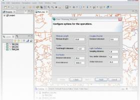 [ Zoom screenshot ] |
|
| Software Info | |
|
Best Vista Download periodically updates pricing and software information of uDig full version from the publisher,
but some information may be out-of-date. You should confirm all information. Software piracy is theft, using crack, warez passwords, patches, serial numbers, registration codes, key generator, keymaker or keygen for uDig license key is illegal and prevent future development of uDig. Download links are directly from our mirrors or publisher's website, uDig torrent files or shared files from rapidshare, yousendit or megaupload are not allowed! |
|
| Released: | November 22, 2018 |
| Filesize: | 166.00 MB |
| Platform: | Windows XP, Windows Vista, Windows 7, Windows 8, Windows 10 |
| Install | Instal And Uninstall |
| Add Your Review or Windows Vista Compatibility Report |
uDig- Releases History |
| Software: | uDig 2.0.0 |
| Date Released: | Nov 22, 2018 |
| Status: | New Release |
| Release Notes: | BUGFIXES #261 fix problem causing deadlock while copying features between the same shapefile layer #258 Fix issue causing always full layer export of abstract geometry types #253 fix NullPointerException during initial loading of ProjectExplorer #251 fix issue with empty geom while addingEdges is called #237 Map project file not deleted from file system fix locationtech [bug-168] #235 Problem with Map restoration from file system when reopening udig #234 IllegalStateException when closing udig while Map with MySQL layer is open #229 minor fix for duplicate legend entries for color ramp rasters #228 Features modification & copy/paste fails for shapefile layers #215 Fixed resulting pdf page size format |
| Software: | uDig 1.4.0 |
| Date Released: | Jan 7, 2014 |
| Status: | New Release |
| Release Notes: | Bug: [UDIG-1537] - Ensure Libs has correct source jars for GeoTools to aid debuggin [UDIG-1596] - WMS GetCapabilities does not attempt to use version 1.3.0 [UDIG-1866] - Printing prints black pages [UDIG-1935] - ProjectUIPlugin causes SWTException invalid thread access because of FeatureEditorExtensionProcessor [UDIG-1937] - NullPointerException on empty Layer and "View line orientation" [UDIG-1941] - Color Theming Error [UDIG-1945] - Eclipse General Wizards listed [UDIG-1948] - SDK does not resolve sources in net.refractions.udig.libs.source [UDIG-1952] - uDig License Change [UDIG-1958] - WMS GetFeatureInfo 1.3.0 Inconsistent Axis Order [UDIG-1960] - WMS 1.3.0 GetMap exceptions formats [UDIG-1967] - Problems in execution from Geoscript Console [UDIG-1968] - Image and PDF Export from Map is broken (An unexpected failure occurred: null) [UDIG-1976] - DnD into Layers view does not add Layer when Service already registered in Catalog |
| Software: | uDig 1.3.1 |
| Date Released: | Apr 24, 2012 |
| Status: | New Release |
| Release Notes: | New features: · Area of Interest support - define your area of interest based on CRS, current screen or a bookmark · Filter the Table view using the current area of interest - a great way to focus on what is on screen · Updated Info and Profile tool for raster data · Teradata support · Spatial Toolbox view allowing access to OMS3 processing; with tutorial! · New import and export formats: CSV and KML. · Checkout What is new page for details Usability Improvements: · New Tool Palette with easy to use Tool Options for quick access to preferences · New "cheatsheet" help system offering guide assistance to new users · Control Tool interaction with your layers with the ability to mark background layers Additional documentation: · Updated Walkthrough 1 and Walkthrough 2 for the new Tool Palette and Tool Options · Extensive update to online help including uDig Overview · New step by step Introduction to Spatial Toolbox · Updated What is new page |
Most popular user data in Other downloads for Vista |
|
WeatherStudio 2 download by PaulMarv Software
WeatherStudio combines a vast array of live weather data, products, maps, and charts into a single map that the user can pan and zoom. GFS/NDFD/NAM/RAP Model Data, Placefiles, Radar Loops, Satellite, Storm Reports, Hurricane Paths, ...
type: Shareware ($80.00)
View Details
Download
categories: weather, weather tracking software, storm tracking software, weather data, noaa, nws, radar, satellite, software, hurricanes, storms, blizzards, graphics, animations, meteorology, storm chasing, tornadoes, severe weather, spotter, placefiles, model data, GFS, NAM, RAP |
 |
|
Image Metadata Properties Extractor Software 7.0 download by Sobolsoft
This software offers a solution for users who want to extract image property data from one or more PNG, JPG, TIF, BMP ... software allows choice of properties for extraction. The user simply adds image file/s or an entire folder ...
type: Shareware ($19.99)
View Details
Download
categories: png image property extract, extract jpeg file properties, camera model, date taken, extract dimensions from multiple pictures, photo data extraction, image metadata getter, image information harvest, pull, pull out, data, get metadata from pics |
 |
|
Extract RGB Pixel Color Data From Multiple Images Software 7.0 download by Sobolsoft
This software offers a solution to users who want to extract color data from one or more images. The user adds the files or an entire folder for ...
type: Shareware ($19.99)
View Details
Download
categories: extracting color, color explorer, palette, srgb, rgb, red green blue, color picking, picker, single images, bitmap, extracting, extractor, table, pixelated, main, photo, digital images, photographs, pictures, pics, photoshop, colored, save, saving |
|
|
AndreaMosaic 3.53.0 download by Andrea Denzler
... the realm of digital art creation by allowing users to transform a collection of images into a ... also allows for a high degree of customization. Users can control various parameters such as tile size, ...
type: Open Source
View Details
Download
categories: Andrea Denzler, tile, download AndreaMosaic, photographic mosaic, image, AndreaMosaic free download, mosaic, creativity, AndreaMosaic, mosaic creator, render, create mosaic, collage, software, create |
 |
|
packVol 2.6.4 download by Antimo Angelucci
... stress) of each item. With this feature the User can obtain realistic solutions, without the need to ... in C++, with a modern and easy-to-use graphical user interface. The size of the executable is really ...
type: Trialware
View Details
Download
categories: load planner, package optimization, load assistant, load, planner, optimization |
 |
|
EDGE Diagrammer 7.23.2193 download by Pacestar Software
... shapes to styles to diagram templates to the user interface is highly customizable so you can design your own diagram types. ...
type: Shareware ($149.00)
View Details
Download
categories: flowchart, diagram, chart. flow, flowcharting, draw, design, program, software, process, org, network, computer, data, entity |
 |
|
Picture Data 2.1 download by Schwab Software Systems
PictureData 2.1 is designed to allow the user to keep track of all their pictures, movies ... multiple albums. The program allows you to setup users with security to add or edit data. You ...
View Details
Download
|
|
|
TatukGIS Viewer 5.87.0.3409 download by TatukGIS
... an indispensable asset for anyone involved in spatial data analysis, mapping, and visualization. At its core, ... built to handle a wide range of GIS data formats, ensuring seamless integration and compatibility with various ...
type: Freeware
View Details
Download
categories: TatukGIS Viewer, download TatukGIS Viewer, TatukGIS Viewer free download, raster image Viewer, GIS editor, GIS map, viewer, graphic, view, edit |
 |
|
ExifTool 12.86 download by Phil Harvey
... can either be a single file, wrapping existing data, or used as a sidecar file, carrying for ... of any meta information · Ability to add user-defined tags · Recognizes thousands of different tags · ...
type: Freeware
View Details
Download
categories: read meta data, edit meta information, write meta data, exiftool, editor, read |
 |
|
ColorWasher Plugin 3.13 download by Harald Heim
... with actions New Skin feature that imitates the user interface of Lightroom, Photoshop, Photoshop Elements, PaintShop Pro ... Version: Improved PSD support Standalone Version: Improved meta data handling Compatibility: - Plugin Version Runs as ...
type: Demo ($49.95)
View Details
Download
categories: photo filter, picture correction, Photoshop plugin, filter, plugin, Photoshop |
 |