Related Keywords
view 3d surface downloads3d surface downloads
3d surface designer downloads
3d surface inspection downloads
view 3d model downloads
view 3d point clouds downloads
view photos in 3d downloads
view pictures in 3d downloads
3d bone view downloads
3d view downloads
surface downloads
surface test downloads
surface scan downloads
surface mesh downloads
surface fitting downloads
surface area of the body downloads
surface textures downloads
surface map downloads
surface plot downloads
surface modeler downloads
Top Software Keywords
autocad downloadscad downloads
3d cad downloads
drawing downloads
import downloads
design downloads
dwg downloads
pdf to dwg downloads
dxf downloads
convert downloads
convert pdf to dwg downloads
dwg to pdf downloads
converter downloads
dxf to pdf downloads
dwg to dxf downloads
pdf to dxf downloads
dwf to dwg downloads
dwg converter downloads
dwg to jpg downloads
dwg to bmp downloads
stl downloads
dxf to pcl downloads
dwg to tiff downloads
intellicad downloads
pdf to cad downloads
dwg to gif downloads
convert dwg to pdf downloads
dwg to png downloads
dwg to dwf downloads
dxf to ps downloads
Vista Download
Vista downloadVista antivirus download
Vista wallpaper download
Vista wallpapers download
Vista themes download
Vista pack download
Vista ultimate download
Vista home download
Vista basic download
Vista business download
Vista x64 download
Vista transformation download
Vista transformation pack download
Vista boot download
Vista dvd download
Vista sidebar download
Vista aero download
Vista product key download
Downloads RSS
Top Downloads
Top Rated
Navigation: Home
\ Graphic Apps
\ CAD \ 3D FastView
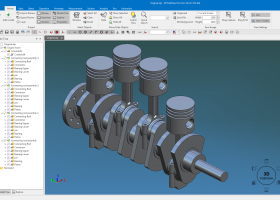
3D FastView1.0 by Gstarsoft Co.,Ltd. |

|
Software Description:
3D FastView can view, assemble, markup, and compress large 3D CAD files. The capability to handle and compress large 3D CAD files make users access and communicate 3D data without expensive CAD license and maintenance cost. Its world-leading 3D data compress technology (from 10GB to 380MB) and practical functions allow inexperienced users to handle and assemble large 3D CAD files easily and efficiently, reducing hardware and training costs. ...
Download 3D FastViewAdd to Download Basket Report virus or spyware |
 [ Zoom screenshot ] |
|
| Software Info | |
|
Best Vista Download periodically updates pricing and software information of 3D FastView full version from the publisher,
but some information may be out-of-date. You should confirm all information. Software piracy is theft, using crack, warez passwords, patches, serial numbers, registration codes, key generator, keymaker or keygen for 3D FastView license key is illegal and prevent future development of 3D FastView. Download links are directly from our mirrors or publisher's website, 3D FastView torrent files or shared files from rapidshare, yousendit or megaupload are not allowed! |
|
| Released: | June 18, 2019 |
| Filesize: | 734.24 MB |
| Language: | English, Chinese, Korean |
| Platform: | Win2000, Windows XP, Windows 7 x32, Windows 7 x64, Windows 8, Windows 10, WinServer, WinOther, Windows Vista, Windows Vista x64 |
| Requirements: | Windows 7 and above ×86/ ×64 |
| Install | Install and Uninstall |
| Add Your Review or Windows Vista Compatibility Report |
3D FastView- Releases History |
| Software: | 3D FastView 1.0 |
| Date Released: | Jun 18, 2019 |
| Status: | New Release |
Most popular view 3d surface in CAD downloads for Vista |
|
PyMOL 3.0.3 download by DeLano Scientific LLC
... representation, molecular state, frame, and movie can be viewed by colleagues exactly as intended. Using ... nearly 20 different ways. Spheres provides a CPK-like view, surface and mesh provide more volumetric views, lines ...
type: Shareware ($99.00)
View Details
Download
categories: molecular visualization, molecular model, 3D molecular structure, molecular, visualization, structure |
 |
|
TriSpace 2021.24.3.652 download by GEOSTRU
... plans, contoured elevation plans, dynamic sections, three dimensional views, distances or areas and volume calculations. Thus this ... plans can be associated on each level; 3D view of individual surveys or complete levels; Choice of ...
type: Trialware ($500.00)
View Details
Download
categories: Terrain Calculation, 3D Terrain Viewer, View 3D Surface, Calculation, Terrain, Surface |
 |
|
TNTmips 20240404 download by MicroImages, Inc.
... any type of geospatial data including imagery, terrain surfaces, and map data with associated database attributes. It provides all the tools you need to view, create, edit, georeference, interpret, and publish any type ...
type: Freeware
View Details
Download
categories: GIS data analysis, analyze geodetic data, edit GIS dataset, GIS, dataset, editor, analysis |
 |
|
CARIS Easy View 4.2.13 download by CARIS
CARIS Easy View is a simple application that enables you to view spatial data imported from numerous types of files. ... layers, change their order and adjust object parameters. View your spatial data using the free CARIS viewer. ...
View Details
Download
|
 |
|
ShapeBook with 2D3DSteel 4.4.2009 download by South Fork Technologies, Inc.
... calculator that creates steel material lists with weight, surface area, and price extensions. ShapeBook also includes a ... coatings. The Calculator Material List extends the weight, surface area, and pricing (price per pound or kilogram) ...
type: Shareware ($149.95)
View Details
Download
categories: structural, steel, detailing, estimating, dimensions, design, properties, software, reference, tools, construction, reference, information, engineering, fabrication, fabricator, drafting, architecture, beam, column, CAD, drawings, detailing, architect, computer, programs |
 |
|
CADbro 2020 download by ZWSOFT CO., LTD.(Guangzhou)
CADbro is a 3D CAD viewer that helps with your collaboration on engineering data. ... management, production planning, manufacturing, technical documentation. Open and view file created by NX, Catia, Creo ProE and ...
type: Shareware ($1 500.00)
View Details
Download
categories: CAD viewer, Cloud, 3D CAD viewer, 3D viewer, 3D converter, CAD converter, 3D translator, CAD translator, Catia viewer, Solidworks viewer, DWG viewer, DXF viewer, Creo viewer, PTC viewer, UG viewer, STL viewer, Step viewer, DWG converter, DXF converte |
 |
|
TriSpace 2021.24.3.652 download by GEOSTRU
... plans, contoured elevation plans, dynamic sections, three dimensional views, distances or areas and volume calculations. Thus this ... plans can be associated on each level; 3D view of individual surveys or complete levels; Choice of ...
type: Trialware ($500.00)
View Details
Download
categories: Terrain Calculation, 3D Terrain Viewer, View 3D Surface, Calculation, Terrain, Surface |
 |
|
Maxsurf 17.07 download by Bentley Systems
... and appendages. An unlimited number of trimmed NURB surfaces can be used to model any vessel from ... with limited training time. Any number of NURB surfaces can be joined, trimmed and manipulated to create ...
View Details
Download
|
 |
|
TopoLT 15.2 download by CADWARE Engineering
... restrictions (the volume obtained by intersecting a 3D surface with a plane or the volume between two 3D surfaces of any grid form or triangles); · 3D ... numbered sheets can be created in order to view or print plan by plan when there are ...
type: Trialware ($600.00)
View Details
Download
categories: topographical plan, cadastral plan, terrain model, topography, cadaster, terrain |
 |
|
Maxsurf 17.07 download by Bentley Systems
... and appendages. An unlimited number of trimmed NURB surfaces can be used to model any vessel from ... with limited training time. Any number of NURB surfaces can be joined, trimmed and manipulated to create ...
View Details
Download
|
|